Home / Weather / Winter Storm Paralyzes US: Snow, Ice, and School Closures!
Winter Storm Paralyzes US: Snow, Ice, and School Closures!
10 Feb
Summary
- Winter storms are causing heavy snow and dangerous travel conditions nationwide.
- School districts are delaying or closing due to hazardous weather and icy roads.
- Up to 20 inches of snow is forecast for some higher elevations and northern states.
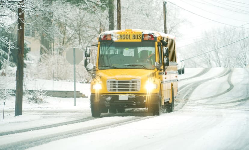
A powerful winter storm is currently sweeping across the United States, bringing significant snowfall and dangerous travel conditions. As of February 10, 2026, numerous regions are experiencing heavy snow, prompting winter storm warnings and advisories from the National Weather Service. Some mountainous and northern areas are expecting substantial accumulations, with strong winds leading to reduced visibility and near-whiteout conditions. This hazardous weather has led to school districts considering class delays or closures for Tuesday, February 11, 2026.
In Kentucky, persistent ice and snow have created unsafe conditions for school transportation, with Fayette County Public Schools canceling in-person instruction on Monday and announcing a delay for Tuesday due to slick roads. This situation reflects a broader national pattern, as winter storms impact areas from the West to the Upper Midwest and Northeast. Some forecasts predict up to 20 inches of snow in certain locations, particularly at higher elevations, making travel extremely treacherous.
Winter weather advisories and warnings are active in states including Maine, New Hampshire, Vermont, New York, Michigan, Wisconsin, Montana, Wyoming, California, and Alaska. The timing of these advisements varies, meaning disruptions might occur on different days for different regions. For instance, impacts in the Northeast, including morning bus routes, could extend into Wednesday, February 12, 2026. Emergency managers are strongly advising drivers to exercise extreme caution, as the combination of heavy snow, wind, and fluctuating temperatures increases accident risks and can impede emergency response times. The active winter pattern is expected to persist through at least midweek, with additional snow possible in some areas.