Home / Weather / UK Braces for Icy Blast: Snow Flurries Forecast
UK Braces for Icy Blast: Snow Flurries Forecast
3 Dec
Summary
- An Arctic blast will bring icy temperatures and snow flurries across the UK.
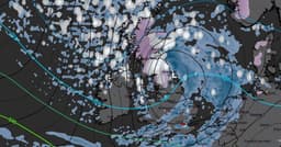
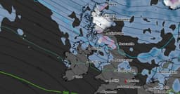
- Snow is expected to be heaviest around Manchester and Leeds on December 12.
- The Met Office predicts unsettled weather with rain and strong winds initially.
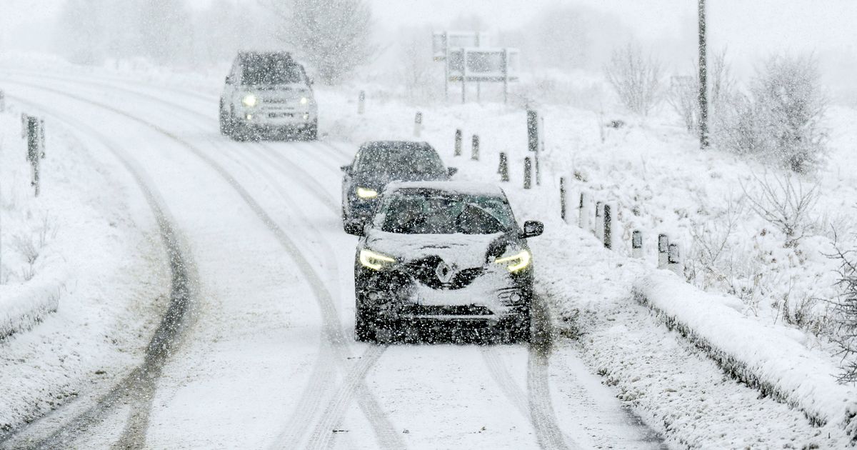
An impending Arctic blast is set to bring a significant chill to the UK, with forecasts indicating icy temperatures and widespread snow flurries. Weather maps suggest snow is likely across England, Scotland, and Wales around midday on December 12. The heaviest snowfall is anticipated in northern England, particularly near Manchester and Leeds, with flurries also expected in parts of north Wales and west Scotland.
The Met Office predicts a period of unsettled weather from December 8 to 17, characterized by strong winds and rain. Initially, conditions might be fair, but a system of rain and wind is expected to move in early next week, followed by showers. More rain bands could sweep across the country in the subsequent days, bringing potentially very strong winds and cooler temperatures that may feel chilly.
Looking towards the festive period, the national agency suggests a greater chance of drier conditions from December 18 onwards. This could lead to more overnight fog and frost. While generally near or slightly above average temperatures are most likely, colder spells are still possible, especially if settled weather patterns develop.