Home / Weather / Brace for Impact: UK Snowstorm Looms!
Brace for Impact: UK Snowstorm Looms!
25 Nov, 2025
Summary
- Snowfall up to 17cm expected in parts of Scotland.
- Two weather fronts to bring snow and rain from December 3rd.
- Temperatures to remain near or slightly above average.
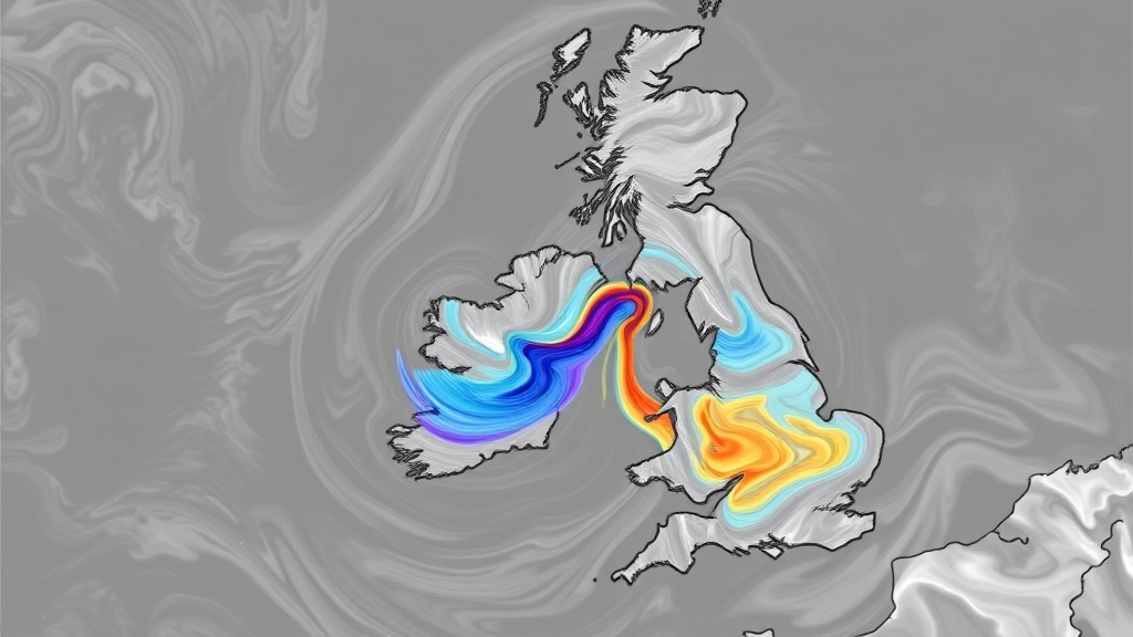
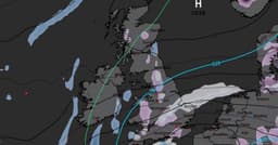
Advanced weather modelling indicates that the UK is facing another snowstorm in the coming days, with forecasts suggesting accumulations of up to 17cm of snow. The initial weather front, originating from the Atlantic, is projected to arrive on December 3rd, primarily affecting Northern Ireland and Scotland. Central and northern Scotland could experience heavy snowfall, while Northern Ireland may see intense rain.
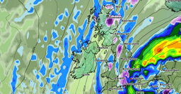
As the first front moves south, a second is expected on December 4th, impacting Wales and central England. North Wales might experience brief heavy snow, with rain elsewhere. The Cairngorms National Park in Scotland is predicted to receive the most significant snow depth, potentially reaching 17cm. Lighter accumulations are possible in Northern Ireland, North Wales, and southern Scotland.
The Met Office and BBC Weather forecasts for early December suggest changeable conditions with a risk of rain, particularly in western areas. Snow is likely to be confined to high ground in the north. Despite the wintry outlook, temperatures are expected to be close to or slightly above the December average, with potential for frost and fog on calm nights.