Home / Weather / UK Braces for Blizzard: 4 Inches of Snow Per Hour Incoming!
UK Braces for Blizzard: 4 Inches of Snow Per Hour Incoming!
24 Jan
Summary
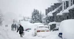
- Heavy snow and torrential rain are expected across the UK next week.
- Some areas could experience up to four inches of snow per hour.
- Scottish Highlands may see up to 69cm of snow accumulation.
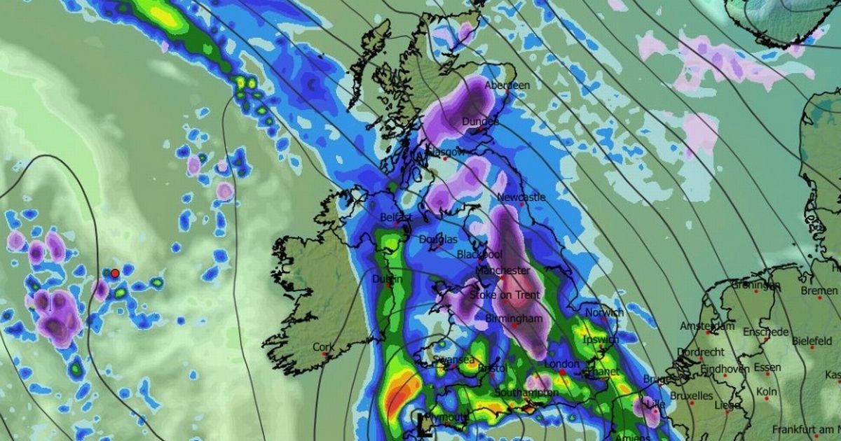
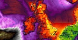
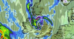
A major storm is predicted to impact the UK next week, bringing a mix of heavy rain and significant snowfall. Weather modelling suggests snow could begin falling in Wales, the Midlands, northern England, and Scotland early Tuesday, with intense flurries of up to one inch per hour initially. This snowfall is expected to intensify, potentially reaching four inches per hour over the Peak District by mid-morning Tuesday, with Manchester and Birmingham also in the projected path.
By Tuesday afternoon, snow may become more sporadic, with wintry showers affecting the south-west, East Anglia, Wales, Northern Ireland, and parts of northern England and Scotland. Evening forecasts indicate a resurgence of heavy snow, particularly over Yorkshire and the Pennines, with rates possibly hitting four inches per hour again in northern England by 9 pm.
Snow depth charts suggest limited accumulation in southern UK regions, although flurries may drift south. However, the Scottish Highlands could accumulate as much as 69cm, northern England hills up to 24cm, Wales 7cm, and Northern Ireland 2cm. The Met Office and BBC forecasts corroborate the likelihood of snow, especially over northern hills and higher ground, as colder air moves in from the northeast.