Home / Weather / Houston Braces for Flooding as Storms Roll In
Houston Braces for Flooding as Storms Roll In
1 May
Summary
- Heavy rains may cause street flooding on Friday.
- A stray tornado is possible Friday.
- Cooler air and sunshine expected by Sunday.
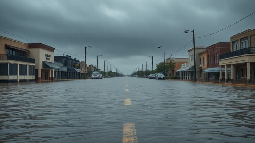
A significant weather shift is expected across Southeast Texas on Thursday, with a slow-moving cold front enhancing the chances for showers and storms. By Friday, this front will stall, coinciding with another system approaching from the west. This combination raises concerns for widespread heavy rainfall, with potential street flooding being a primary worry for May 1st.
While Thursday may see scattered showers and storms, particularly in the afternoon as temperatures rise into the low 80s, Friday presents a more substantial threat. The primary concern for Friday is significant street and urban flooding due to potentially heavy rainfall rates of 1 to 2 inches per hour. The Weather Prediction Center has highlighted Southeast Texas with a slight risk for flooding. A stray strong storm could produce heavy rainfall, gusty winds, and small hail, with a minor possibility of a brief tornado on Friday.
Following the frontal system's departure by Saturday morning, any lingering rain should clear. Cooler air will move in, bringing morning lows in the 50s. Saturday afternoon's temperatures will depend on how quickly clouds dissipate. Sunday is forecast to be spectacular, with abundant sunshine and warm temperatures reaching the upper 70s.