Home / Weather / Texas Braces for Sudden Cold Snap and Possible Snow
Texas Braces for Sudden Cold Snap and Possible Snow
6 Jan
Summary
- Cold front approaching Texas from the northwest, bringing lower temperatures.
- Snow or a rain-snow mix is possible, especially in northern Texas.
- Current snowfall in Amarillo is significantly below average for the season.

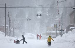
Much of Texas has been experiencing unusually warm weather since the holidays, but this pattern is set to change. By Thursday, a cold front moving from the northwest will bring significantly colder temperatures and increased winds to the state. Meteorologists from the National Weather Service (NWS) in Amarillo have indicated that this could lead to areas of snow or a rain-snow mix developing on Friday, with northern Texas and the Oklahoma Panhandle being the most likely areas to see precipitation.
While the exact amounts of snow are uncertain and depend on precise temperature profiles and system timing, current forecasts suggest lighter accumulations. This winter weather outlook contrasts sharply with the current season's low snowfall. For instance, Amarillo has only recorded 0.2 inches of snow, far below its average of 7.6 inches for this period. This scarcity is attributed to a persistent high-pressure system across the U.S. that has kept temperatures mild and reduced precipitation chances.
Beyond the potential for snow in the north, cooler temperatures and rain are expected in southeast Texas, including Houston, by Thursday and Friday, with a dip in temperatures anticipated over the weekend. Looking further out, the NWS Climate Prediction Center forecasts a return to above-average temperatures for the Texas panhandle between January 10 and January 14, with a more mixed temperature outlook for the southern half of the state.