Home / Weather / Southeast Michigan Braces for Severe Storms and Flooding
Southeast Michigan Braces for Severe Storms and Flooding
14 Apr
Summary
- Southeast Michigan faces an enhanced risk for severe weather.
- Rainfall could range from 1.5 inches to as much as 4 inches.
- Severe storm activity is expected primarily between 10 p.m. and 2-3 a.m.
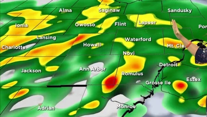
A flood watch has been issued for all of Southeast Michigan as heavy rainfall is anticipated from Tuesday night into Wednesday morning. The region is experiencing an enhanced risk for severe weather, with projections suggesting 1.5 inches of rain, potentially reaching 2-4 inches in some areas. This has prompted a 4Warn Weather Alert for the period.
The severe weather, including potential heavy rain and flooding, is expected to peak between 10 p.m. Tuesday and 2-3 a.m. Wednesday. Additionally, the risk of tornadoes has slightly increased from 2% to 5%, with a possibility of more intense spin-up tornadoes. The potential for severe wind gusts has also been elevated from 15% to 30%.