Home / Weather / Arctic Blast Hits Pittsburgh: Frostbite Danger Looms
Arctic Blast Hits Pittsburgh: Frostbite Danger Looms
20 Jan
Summary
- Record low of -18°F set in 1985 is under threat.
- Frostbite can occur in as little as 30 minutes.
- Snow is expected Wednesday and again over the weekend.
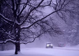
Dangerously low temperatures have gripped the Pittsburgh area, with frigid air expected to persist through the upcoming week. Today has been designated a First Alert Weather Day due to the extreme cold, and the potential for further alerts exists over the weekend due to both snow and temperatures. The current cold snap threatens the record low of -18°F, set in 1985.
Wind chills are ranging between -5°F and -15°F, creating conditions where frostbite can develop in as little as 30 minutes. The National Weather Service warns of serious risks to exposed skin. Homeowners are urged to locate their main water shut-off valve to prepare for potential pipe bursts caused by the prolonged freezing temperatures.
Looking ahead, highs are forecast to reach the mid to upper teens, with wind chills around 0°F. Morning lows will continue to dip into the low single digits over the weekend and into early next week. Snow is anticipated on Wednesday and again over the weekend, with greater accumulation possible in surrounding states.