Home / Weather / NJ Braces for Double Threat: Heat and Storms!
NJ Braces for Double Threat: Heat and Storms!
12 Jun
Summary
- Severe thunderstorms with gusty winds and hail possible Thursday.
- Heat index will reach 105 degrees, posing a danger.
- Two rounds of storms expected, bringing wind and flash flood risks.
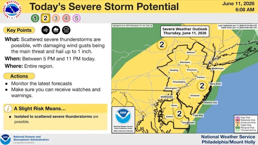
New Jersey residents are preparing for a significant weather shift as dangerous heat and humidity grip the state. Severe thunderstorms are anticipated Thursday evening, potentially unleashing damaging winds and quarter-sized hail. This follows a period of soaring temperatures and humidity, with heat index values expected to reach 105 degrees in many areas.
A heat advisory remains in effect through Friday due to these extreme conditions. Another round of severe thunderstorms is predicted for Friday afternoon and evening as a cold front approaches. Damaging wind gusts and localized flash flooding are the main concerns during this second storm event.
Looking ahead, the cold front's passage on Friday night will bring a noticeable drop in humidity for the weekend. While Saturday and Sunday will still be hot, cooler temperatures are expected from Monday through Wednesday, with highs in the upper 70s to mid-80s.