Home / Weather / UK Faces Colossal 420-Mile Snow Wall as Temperatures Plummet
UK Faces Colossal 420-Mile Snow Wall as Temperatures Plummet
13 Nov, 2025
Summary
- Scotland and northern England to see heaviest snowfall
- Temperatures in Scotland to average in the minuses
- Significant snow risk across the UK in the coming weeks
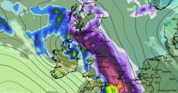
According to the latest weather forecasts, the UK is bracing for a dramatic winter weather event in the coming weeks. Meteorologists have released detailed maps and charts showing a colossal 420-mile wall of snow that is expected to batter large parts of the country, just as temperatures plummet towards -7°C or lower.
The areas set to be hit the hardest are Scotland and the north of England, with the east and southeast of England, including London, also expected to receive significant snowfall around November 20th. Cities like Glasgow, Aberdeen, Edinburgh, Newcastle, Blackpool, Manchester, and Belfast are all predicted to receive between four and eight inches of snow.
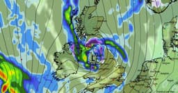
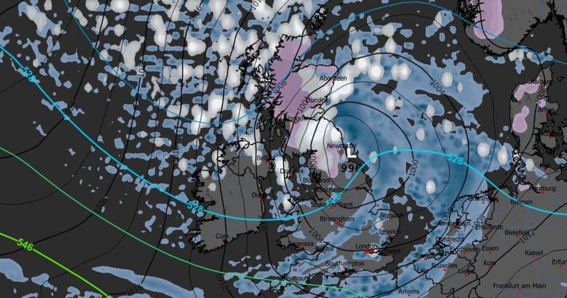
The cold air from the north and east, combined with moisture-laden weather fronts, is creating a high risk of heavy snowfall across the UK. Forecasters warn that overnight temperatures in the north could drop below freezing, increasing the chances of precipitation falling as snow rather than rain.
While the exact timing and depth of the snowfall remain uncertain, the Met Office has highlighted an increased probability of a cold northerly flow with wintry showers and overnight frost in the coming weeks. Residents are being advised to prepare for potential travel disruptions, with roads and railways facing delays or closures, especially in areas of heavier snowfall.