Home / Weather / Kentucky Faces Golf Ball Hail, 60 MPH Winds
Kentucky Faces Golf Ball Hail, 60 MPH Winds
2 Apr
Summary
- Severe thunderstorms with large hail and strong winds impact eastern Kentucky.
- Residents are urged to seek immediate shelter in sturdy buildings.
- The storm poses significant risks to property and individuals outdoors.
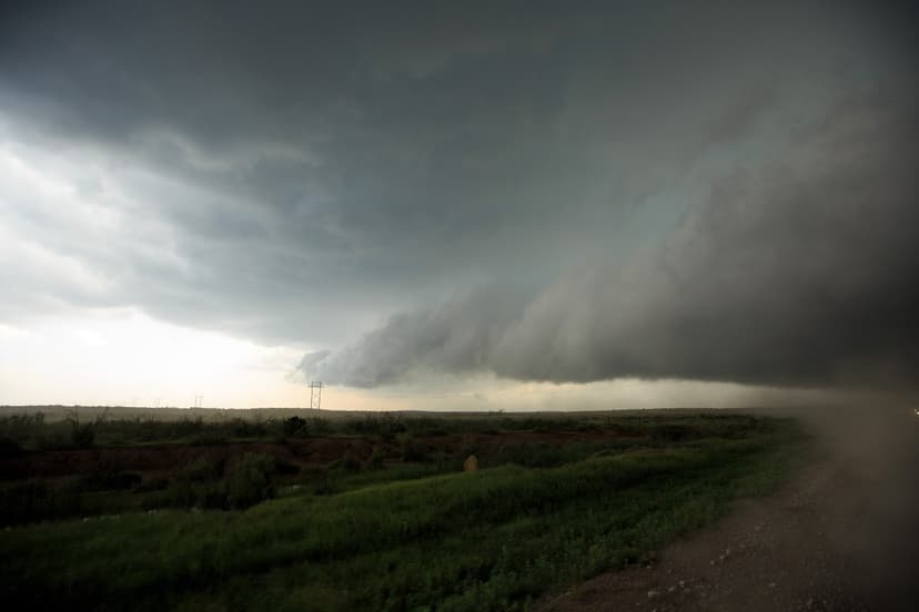
Severe thunderstorms are currently impacting eastern Kentucky, bringing the threat of destructive, golf ball-sized hail and wind gusts up to 60 mph. Forecasters have issued urgent warnings for Morgan, Johnson, Rowan, and Elliott counties, emphasizing that "people and animals outdoors will be injured." The National Weather Service in Jackson, Kentucky, advises immediate relocation to sturdy shelters due to the considerable threat level.
The severe thunderstorm warning, initially set to expire at 4:45 p.m. local time on Wednesday, underscores the danger to homes, vehicles, and anyone exposed. Residents are advised to expect damage to roofs, siding, windows, and trees. Severe thunderstorm watches have also been issued for parts of West Virginia, Ohio, and Indiana, with a broader watch covering several states including Kentucky until 8 p.m. local time.
Meteorologists warn that powerful winds, hail, and flooding are the primary hazards expected this week, with potential for tornadoes. The most intense weather may occur after dark, making multiple warning systems crucial for safety. Although no tornado warnings were issued as of Wednesday afternoon, the outlook necessitates preparation and monitoring of real-time weather alerts.