Home / Weather / Florida Braces for Arctic Blast: Snow Possible in Panhandle!
Florida Braces for Arctic Blast: Snow Possible in Panhandle!
18 Jan
Summary
- Central Florida faces potential freeze watches with wind chills in the 20s.
- Panhandle may experience rain mixed with brief snow before tapering.
- Temperatures will significantly drop, with highs in the 50s by Monday.
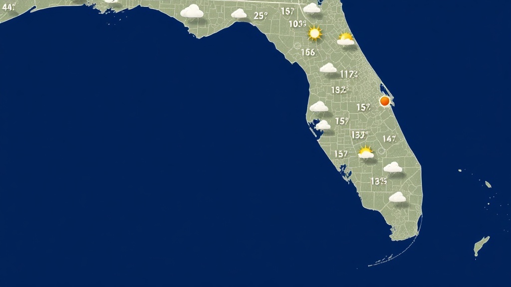
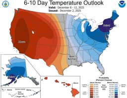
As the weekend begins, Florida's temperatures are set to rise toward seasonable levels, with highs reaching the lower to middle 70s. However, this warmth is short-lived as a cold front approaches, bringing increasing clouds and the potential for showers, especially northwest of Orlando, as dawn nears.
The cold front is expected to make its way into Central Florida through Sunday, spreading rain and a possibility of snow across the Panhandle. While snow may briefly mix with rain in areas like the Capital and Panama City Beach, little to no accumulation is anticipated. Following the front, temperatures will tumble, with Sunday's highs only reaching the lower to mid-60s and wind chills falling into the 40s and 50s.
The workweek starts with a stark contrast as Orlando anticipates lows in the low to mid-30s by Monday morning, with some northern neighborhoods dipping into the upper 20s. Freeze watches have been issued for much of Central Florida. Wind chills will remain in the 20s, necessitating warm clothing. Highs on Monday will struggle to reach the mid to upper 50s despite abundant sunshine. Temperatures are expected to moderate through the week, with highs back in the 70s by Wednesday.