feedzop-word-mark-logo
searchLogin
Feedzop
homeFor YouUnited StatesUnited States
You
bookmarksYour BookmarkshashtagYour Topics
Trending
trending

Tesla shareholders approve Musk's pay

trending

AI elevates employees, not replaces

trending

Singapore DBS embraces AI

trending

Porsche opens Shanghai R&D hub

trending

Guangzhou prepped for National Games

trending

Johannesburg traders face eviction

trending

Toronto housing complex rebuild plan

trending

Ybor City crash kills four

trending

Mega Millions jackpot grows

Terms of UsePrivacy PolicyAboutJobsPartner With Us

© 2025 Advergame Technologies Pvt. Ltd. ("ATPL"). Gamezop ® & Quizzop ® are registered trademarks of ATPL.

Gamezop is a plug-and-play gaming platform that any app or website can integrate to bring casual gaming for its users. Gamezop also operates Quizzop, a quizzing platform, that digital products can add as a trivia section.

Over 5,000 products from more than 70 countries have integrated Gamezop and Quizzop. These include Amazon, Samsung Internet, Snap, Tata Play, AccuWeather, Paytm, Gulf News, and Branch.

Games and trivia increase user engagement significantly within all kinds of apps and websites, besides opening a new stream of advertising revenue. Gamezop and Quizzop take 30 minutes to integrate and can be used for free: both by the products integrating them and end users

Increase ad revenue and engagement on your app / website with games, quizzes, astrology, and cricket content. Visit: business.gamezop.com

Property Code: 5571

Home / Weather / Flooding Rains and Tornado Threat Loom as Florida Braces for Tropical Disturbances

Flooding Rains and Tornado Threat Loom as Florida Braces for Tropical Disturbances

3 Oct

•

Summary

  • National Hurricane Center monitoring two areas for potential storm development
  • Flooding rains and tornado risk for Florida's east coast in the coming days
  • Possibility of a new named storm approaching the Caribbean next week

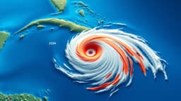
As of October 3rd, 2025, the National Hurricane Center is closely monitoring two areas in the Atlantic for potential storm development over the next week. One system near Florida is expected to enhance heavy rainfall and flooding across the Sunshine State, while another disturbance in the open waters of the eastern Atlantic could approach the Caribbean islands later next week.

The first system near Florida is not expected to intensify into a tropical storm, but it will still bring a significant threat of flooding rains to the state's east coast. Localized rainfall totals could exceed a foot, and there is even a low-risk of isolated tornadoes or waterspouts in the Miami to Fort Lauderdale and Port St. Lucie corridor. The heavy, thunderstorm-driven rainfall has already led to highly variable totals, with some areas seeing over 7 inches while nearby locations have received only an inch or so.

Meanwhile, the second disturbance in the eastern Atlantic has a 40% chance of developing into a named storm, potentially impacting the Leeward Islands and Puerto Rico by the middle of next week. The forecast for this system remains uncertain, as it could either continue westward towards the Caribbean or curve out to sea, depending on the strength of the "Bermuda high" and the system itself.

With exceptionally warm sea surface temperatures and a favorable atmospheric pattern, the tropics are expected to remain active through mid-to-late October, increasing the potential for additional tropical storms and hurricanes to form in the Gulf of Mexico, Caribbean, or western Atlantic.

Disclaimer: This story has been auto-aggregated and auto-summarised by a computer program. This story has not been edited or created by the Feedzop team.
The National Hurricane Center is monitoring two areas in the Atlantic - one near Florida and another in the open waters of the eastern Atlantic.
The system near Florida is expected to bring heavy, flooding rains to the state's east coast, with localized rainfall totals potentially exceeding a foot. There is also a low-risk of isolated tornadoes or waterspouts in the Miami to Fort Lauderdale and Port St. Lucie corridor.
The second disturbance in the eastern Atlantic has a 40% chance of developing into a named storm and could approach the Leeward Islands and Puerto Rico by the middle of next week. The forecast for this system remains uncertain, as it could either continue westward towards the Caribbean or curve out to sea.

Read more news on

Weatherside-arrowFloridaside-arrowPuerto Ricoside-arrowMiamiside-arrowAtlantic Oceanside-arrowCaribbean islandsside-arrowLeeward Islandsside-arrow

Advertisement

Advertisement

Advertisement

You may also like

Deadly Hurricane Melissa Wreaks Havoc Across Caribbean

30 Oct • 47 reads

article image

Melissa Weakens After Devastating Caribbean Rampage

31 Oct • 49 reads

article image

Catastrophic Hurricane Melissa Targets Jamaica, Threatens Caribbean

28 Oct • 62 reads

article image

Tropical Storm Jerry Weakens as Nor'easter Floods Florida

11 Oct • 124 reads

article image

Tropical Storm Octave Brews in Pacific as Imelda Moves Away from Bermuda

2 Oct • 264 reads

article image