Home / Weather / East Coast Braces for Floods, Winds, and Tornadoes
East Coast Braces for Floods, Winds, and Tornadoes
20 Aug
Summary
- Over 25 million people face flood watches along the I-95 corridor.
- Storms may bring intense rain rates of 1 to 3 inches per hour.
- Damaging wind gusts and isolated tornadoes are possible threats.
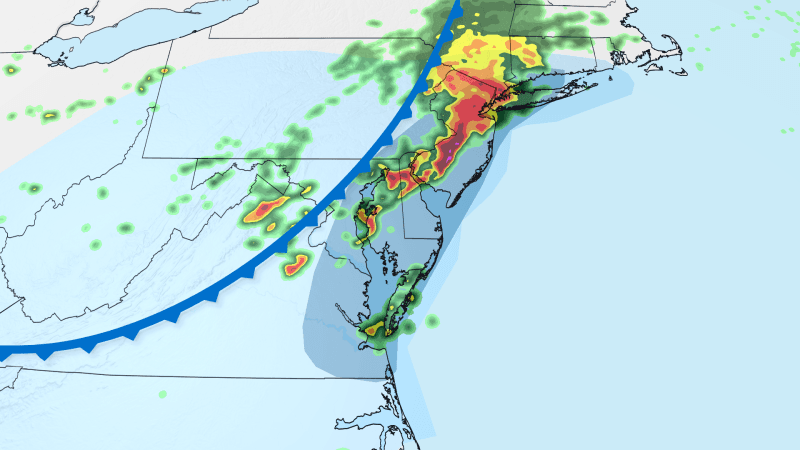
Drenching storms are sweeping across the East Coast, carrying the risk of significant flash flooding, powerful wind gusts, and even isolated tornadoes. Over 25 million individuals residing along the Interstate 95 corridor, encompassing areas from New York City down through northern Delaware and Philadelphia, are currently under flood watches.
The storms are anticipated to intensify by late afternoon and persist through the evening, potentially causing severe disruptions for commuters. These weather systems are an extension of a cold front that previously generated flash flooding in central Ohio earlier on Thursday, leading to reported water rescues and road closures.
Northeastern locations could experience intense rainfall, with rates reaching 1 to 3 inches per hour. Such heavy downpours are known to cause rapid flash flooding, particularly in urban settings like New York City, where infrastructure can be overwhelmed by intense rain.
Beyond the flooding, some storms may produce damaging wind gusts capable of downing trees and causing power outages, especially in central and southern New Jersey, Philadelphia, Delaware, and eastern Maryland. The northern edge of the severe risk area also faces the possibility of isolated tornadoes.
Fortunately, the majority of the heavy rainfall and severe storm threats are expected to dissipate around midnight as the cold front moves off the East Coast.


