Home / Weather / Cyclone Ditwah Weakens, Chennai Braces for More Rain
Cyclone Ditwah Weakens, Chennai Braces for More Rain
2 Dec, 2025
Summary
- Cyclone Ditwah transformed into a deep depression off Chennai's coast.
- The system is expected to make landfall between Kalpakkam and Puducherry.
- Heavy rainfall is forecast for Chennai and surrounding districts until Wednesday noon.
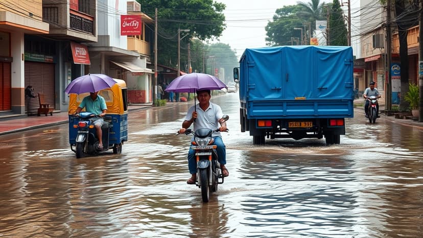
Cyclone Ditwah, having weakened into a deep depression, has been a source of persistent rain for the Chennai region. The weather system has now reversed course, moving south-westwards towards the coast. It is anticipated to make landfall between Kalpakkam and Puducherry by midnight, with further weakening expected into a depression and then a well-marked low-pressure area.
Despite the weakening, weather experts forecast heavy rainfall for Chennai and its surrounding districts until Wednesday noon. Areas such as Chengalpet, Kancheepuram, Vellore, and Tiruvannamalai are also expected to experience precipitation as the system progresses inland. The intensity of clouds over northern Chennai suggests that rain in the city and other districts remains a possibility.
Earlier on Tuesday, several parts of the city experienced intense rainfall, with some areas recording over 20cm in a 24-hour period. The depression's slow movement of 3kmph has sustained its presence, allowing for continued cloud formation. While the system's proximity to the coast, as close as 25km, has been a concern, its weakening and southward movement are considered favorable for Chennai, preventing a more direct impact.