Home / Weather / Baltimore Under Siege: Tornado Warnings Strike Metro Area
Baltimore Under Siege: Tornado Warnings Strike Metro Area
10 Aug
Summary
- Radar confirmed rotation over Randallstown; tornado warnings issued.
- 80 mph wind gusts flagged in destructive storm warning.
- Severe weather risk persists for Baltimore through Wednesday.
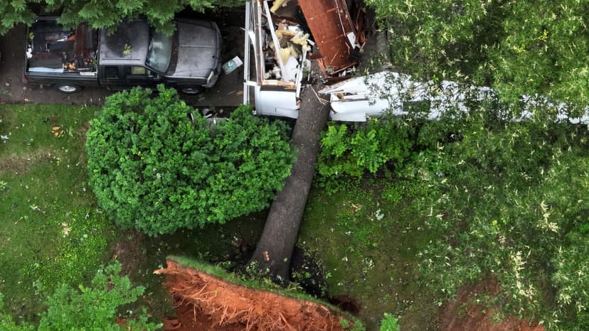
The National Weather Service confirmed radar-indicated rotation over Randallstown, prompting tornado warnings for the Baltimore metro area on Monday afternoon. These warnings, affecting approximately 558,912 residents, 122 schools, and eight hospitals, ordered immediate shelter-in-place. Separately, a destructive storm warning identified 80 mph wind gusts over northern Howard and southwestern Baltimore counties.
The storm system's threat persists, with a Severe Thunderstorm Watch remaining active for much of Maryland until 9 PM ET. The Federal Aviation Administration issued ground stops at major regional airports due to the ongoing thunderstorm activity. Residents are advised to treat any active Severe Thunderstorm Warning as an immediate reason to move indoors.
Radar-indicated rotation signifies Doppler radar detecting a velocity signature consistent with a mesocyclone, a rotating air column within a severe thunderstorm that can produce a tornado. While not a confirmed touchdown, it warrants the same shelter precautions as an actual tornado. This guidance accounts for the potential for severe wind gusts and flying debris, even if a tornado does not form.
Baltimore County experienced two tornado warnings on August 10, with a combined zone encompassing a significant population and numerous institutions. A concurrent 'Destructive Storm' tier Severe Thunderstorm Warning, triggered by radar indicating 80 mph wind gusts, warned of considerable damage to trees and power lines and significant risk to anyone outdoors.
This severe weather is driven by a stalled frontal boundary amplified by El Niño conditions, increasing atmospheric moisture and intensifying storm tracks. This pattern, exacerbated by climate change leading to more frequent stalled weather systems, means storms may linger over the region for multiple days, extending the preparation window beyond a single afternoon.
Forecasters anticipate continued severe weather risk on Tuesday and Wednesday. Residents are urged to charge personal devices, avoid parking under trees or near power lines, and plan alternate routes due to potential road damage. Air travelers should monitor flight status. The BTS Arirang World Tour concert at M&T Bank Stadium on Monday evening was also within the severe weather watch window.


