feedzop-word-mark-logo
searchLogin
Feedzop
homeFor YouUnited StatesUnited States
You
bookmarksYour BookmarkshashtagYour Topics
Trending
trending

Pistons win 11th straight

trending

Ohio State tops CFP rankings

trending

Harrison Barnes leads Spurs victory

trending

Boston Michelin Guide revealed Tuesday

trending

Miss Universe judge quits

trending

Costco stock valuation concerns persist

trending

Google stock jumps after Gemini

trending

Randy Jones Padres dies at 75

trending

Ryan Wedding: Drug Lord

Terms of UsePrivacy PolicyAboutJobsPartner With Us

© 2025 Advergame Technologies Pvt. Ltd. ("ATPL"). Gamezop ® & Quizzop ® are registered trademarks of ATPL.

Gamezop is a plug-and-play gaming platform that any app or website can integrate to bring casual gaming for its users. Gamezop also operates Quizzop, a quizzing platform, that digital products can add as a trivia section.

Over 5,000 products from more than 70 countries have integrated Gamezop and Quizzop. These include Amazon, Samsung Internet, Snap, Tata Play, AccuWeather, Paytm, Gulf News, and Branch.

Games and trivia increase user engagement significantly within all kinds of apps and websites, besides opening a new stream of advertising revenue. Gamezop and Quizzop take 30 minutes to integrate and can be used for free: both by the products integrating them and end users

Increase ad revenue and engagement on your app / website with games, quizzes, astrology, and cricket content. Visit: business.gamezop.com

Property Code: 5571

Home / Science / Tracing the Forgotten Highways of the Ancient Roman Empire

Tracing the Forgotten Highways of the Ancient Roman Empire

10 Nov

•

Summary

  • Researchers mapped over 100,000 km of newly identified Roman roads
  • The expansive network spanned 300,000 km, enough to circle Earth 7 times
  • Map can support future research on connectivity, migration, and disease transmission
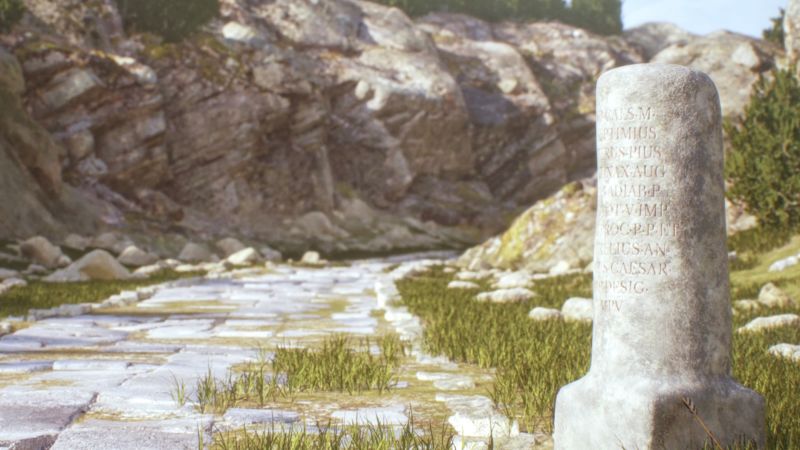
Tracing the Forgotten Highways of the Ancient Roman Empire

In a remarkable feat of historical research, a team of international scholars has created a comprehensive visualization of the ancient Roman road network. The new map, named Itiner-e, includes over 100,000 kilometers (62,000 miles) of newly identified routes, spanning a total network of 300,000 kilometers (186,000 miles) - enough to circle the Earth more than seven times.

The expansive map, which depicts the Roman road system around AD 150, provides a detailed look at how ancient Romans traveled across their vast empire, which stretched from modern-day Britain to Egypt and Syria. The researchers behind the project hope that this groundbreaking visualization will support future studies on the influence of Roman roads on connectivity, migration, and even disease transmission.

To create the map, the researchers cross-referenced a vast array of historical records, satellite imagery, and other data sources. While they were able to pinpoint the exact location of only 2.7% of the roads, the map still offers an unprecedented level of detail and insight into the Roman transportation network. The authors note that this highlights the need for further research to uncover the remaining mysteries of these ancient highways.

Disclaimer: This story has been auto-aggregated and auto-summarised by a computer program. This story has not been edited or created by the Feedzop team.

Read more news on

Scienceside-arrowGreat Britainside-arrowEarthside-arrow

You may also like

India's Cashew Consumption to Double by 2045

15 Nov • 19 reads

article image

Antarctica's Krill Crisis: Fishing Frenzy Threatens Fragile Ecosystem

13 Nov • 69 reads

article image

EV Sector Surges Ahead with Battery and Charging Advancements

14 Nov • 25 reads

article image

Mustard's Surprising Health Benefits: The Condiment That's More Than Just a Topping

15 Nov • 13 reads

article image

HEG Stays Resilient Amid Stable Graphite Electrode Prices and Global Expansion

11 Nov • 37 reads

article image