Home / Science / El Niño's Return: Supercharged Heat Wave Looms
El Niño's Return: Supercharged Heat Wave Looms
9 Apr
Summary
- La Niña has ended, and El Niño is expected to develop.
- A strong El Niño could lead to unusually hot years on record.
- El Niño impacts hurricane seasons in both Atlantic and Pacific.
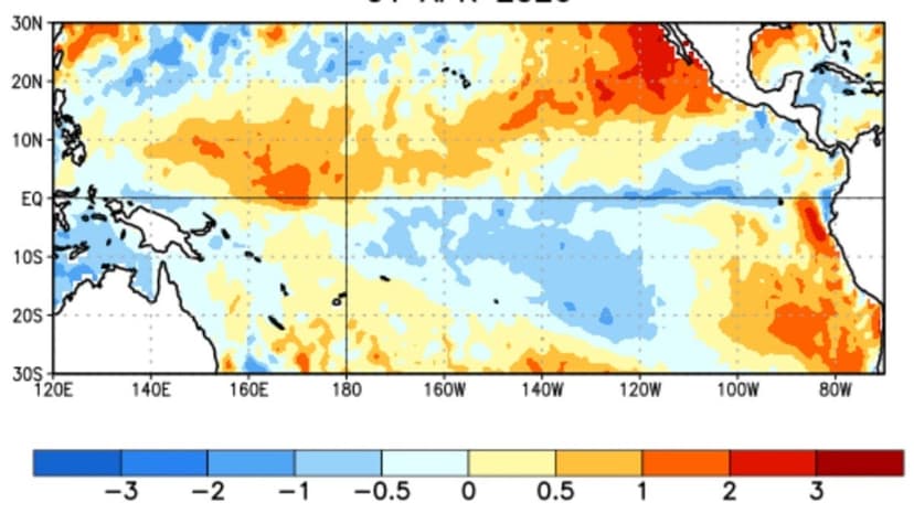
Federal scientists announced the end of the La Niña climate pattern on April 9, 2026, anticipating the development of El Niño later this year. This shift in the El Niño-Southern Oscillation (ENSO) cycle is expected to significantly influence global weather patterns.
El Niño, characterized by warmer-than-average Pacific Ocean surface temperatures, often coincides with the hottest years on record. Projections suggest a potential for an unusually strong El Niño, sometimes referred to as a "Super El Niño," which could lead to unprecedented global heat into 2027.
The transition from La Niña, which had slightly cooled global temperatures and influenced rainfall patterns, occurs during an intermediate ENSO-neutral stage. Forecasters remain cautious due to the spring predictability barrier, a known weakness in climate forecasting during this period.
This climate shift has major implications for hurricane seasons. El Niño typically reduces Atlantic hurricane activity while increasing it in the Pacific. Its influence is also significant for winter weather across the United States, affecting precipitation patterns and potentially bringing severe storms to both coasts.