Home / Environment / UK Braces for 'Beast from the East' Snowstorm
UK Braces for 'Beast from the East' Snowstorm
31 Jan
Summary
- A major snowstorm could bring heavy snow to UK cities starting February 6.
- Up to 20cm of snow is forecast for the Scottish Highlands.
- The Met Office warns of wintry hazards due to shifting weather patterns.

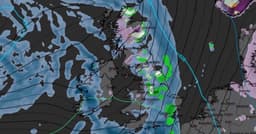
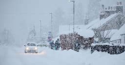
A substantial snowstorm, potentially arriving from the east, is forecast to impact the UK in the coming days. Weather modelling suggests that by the evening of February 6, significant snow could fall over areas such as Birmingham and the Peak District, with intense snowfall expected near the England-Wales border on February 7. Snow coverage maps indicate a widespread wintry blast, with accumulations anticipated across southern England, the Midlands, Wales, northern England, and most of Scotland. The Scottish Highlands may experience up to 20cm of snow, while northern England and Wales could receive up to 5cm.
The Met Office has alerted to the possibility of "wintry hazards" in early February. Their forecast indicates that frontal systems moving from the North Atlantic may stall near the UK, influenced by high pressure to the north and northeast. This setup could lead to rain, and as it moves north, snow is possible on higher ground in northern England and Scotland. A slight shift in low-pressure systems during the second week of February might introduce colder air into the northern UK, increasing the risk of wintry conditions for a period. Further snow is also a possibility later in February.


