Home / Environment / Record Cold Grips New Jersey This Week
Record Cold Grips New Jersey This Week
26 Jan
Summary
- Dangerous cold with single-digit temperatures and sub-zero wind chills is expected.
- Record low temperatures for late January were set in 1963, 1966, and 1873.
- Frostbite and hypothermia are risks due to prolonged exposure to extreme cold.
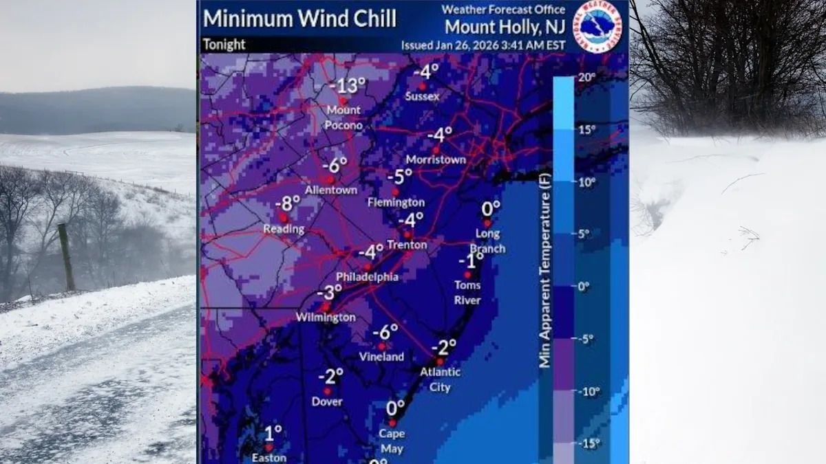
New Jersey is facing a severe cold snap this week, with potentially record-breaking temperatures and dangerous sub-zero wind chills. This arctic blast follows a weekend storm that delivered up to 17 inches of snow across the state. The National Weather Service has issued a cold weather advisory, warning of extended periods with temperatures and wind chills in the single digits and below zero.
Temperatures are expected to remain frigid throughout the week, not rising above freezing until at least the weekend. Monday will be the warmest day, with highs only in the mid to upper 20s, dropping to single digits overnight. Tuesday will see similar conditions, with highs in the upper teens to low 20s and frigid wind chills. A second surge of Arctic air will arrive Wednesday night, bringing even colder temperatures and wind chills potentially reaching minus 20 degrees in some areas.