Home / Environment / Coastal Mapping Empowers Maine's Climate Resilience Efforts
Coastal Mapping Empowers Maine's Climate Resilience Efforts
10 Oct
Summary
- New high-definition map of Maine's coastline released
- Map identifies best areas to fortify against sea-level rise
- Funded by federal grants, despite recent cuts to climate research
In August 2025, a New England remote sensing company, Nearview, released a new high-definition map of Maine's 3,500-mile coastline. The map, called the Coastal Ecosystem Map Application Platform (CEMAP), aims to help local officials, regulators, and seaweed harvesters plan for climate change and manage the state's coastal resources.
The platform was developed over several years, with initial funding from the National Oceanic and Atmospheric Administration. Despite recent cuts to federal climate change research under the Trump administration, Nearview was able to complete the project and make the data publicly available.
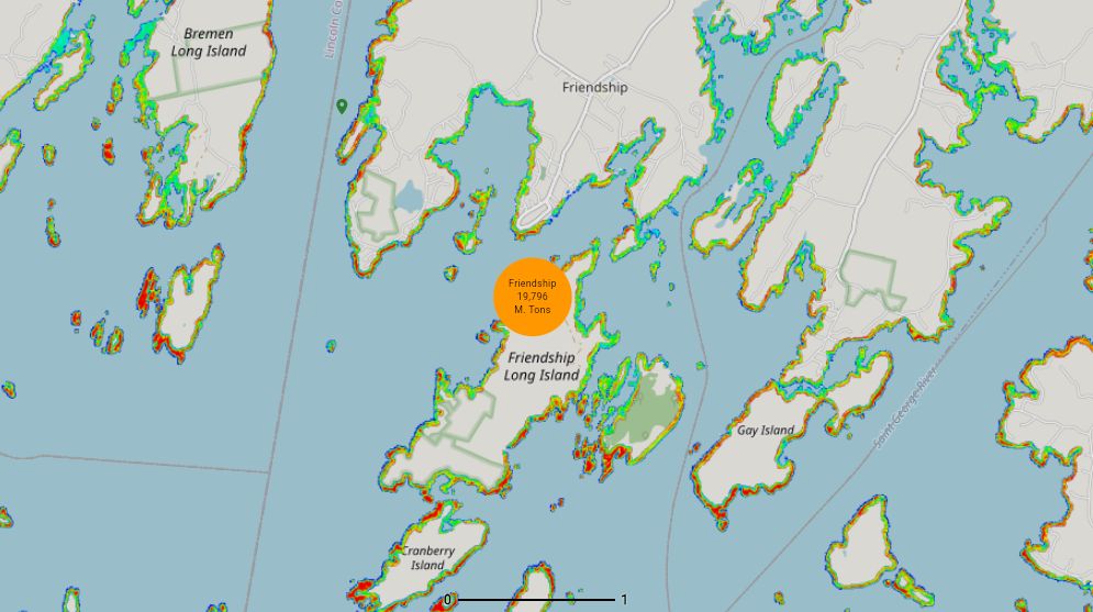
CEMAP includes five different maps, each providing unique insights. One map identifies the best stretches of coastline for dune stabilization and other climate resilience projects. Other maps detail the location and density of aquatic vegetation, such as wild seaweed forests, which could inform sustainable harvesting practices.