Home / Disasters and Accidents / Trimbakeshwar Maps Water Flow for Kumbh Mela Safety
Trimbakeshwar Maps Water Flow for Kumbh Mela Safety
14 Jul
Summary
- Town's water flow patterns are being mapped to assess flooding during heavy rain.
- Data collected will inform a disaster management plan for the 2027 Simhastha Kumbh Mela.
- Recent heavy rains exposed vulnerabilities, causing silt deposits and waterlogging.
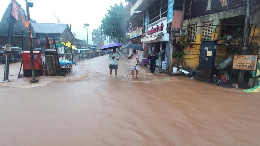
The Trimbakeshwar Municipal Council is undertaking a detailed survey to map the town's water flow patterns during periods of heavy rainfall. This proactive exercise aims to precisely record how quickly specific areas flood and how long it takes for water levels to recede.
Information gathered from this survey will be instrumental in developing a robust disaster management contingency plan. The primary goal is to ensure the safety of the millions of pilgrims expected to visit the temple town for the Simhastha Kumbh Mela in 2027.
Recent heavy rains on July 7 and 8 demonstrated the town's susceptibility to waterlogging and silt deposition, even with its natural drainage systems. Flooding occurred in residential zones, temple premises, and open grounds, highlighting the need for structural remedies.
An administrative team, including Kumbh Mela minister Girish Mahajan and Nashik divisional commissioner Praveen Gedam, visited Trimbakeshwar to assess immediate intervention strategies. This mapping exercise is seen as a critical lesson for upgrading infrastructure to manage extreme weather events during the large-scale pilgrimage.


