Home / Disasters and Accidents / Mexico Coast Shaken by 4.7 Magnitude Quake
Mexico Coast Shaken by 4.7 Magnitude Quake
3 Dec, 2025
Summary
- A magnitude 4.7 earthquake occurred off Mexico's southern coast.
- The epicenter was approximately 50 miles south of El Zapotal.
- Southern Mexico is seismically active due to tectonic plate movement.
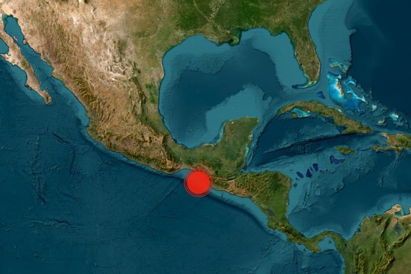
An offshore earthquake with a magnitude of 4.7 jolted the southern coast of Mexico early Wednesday. The seismic event's epicenter was located roughly 50 miles south-southwest of El Zapotal, beneath the Pacific Ocean. Preliminary reports indicated no immediate damage or injuries resulting from the tremor.
This region of southern Mexico is known for its high seismic activity, situated where the Cocos Plate is continuously subducting beneath the North American Plate. This geological process creates the Middle America Trench, a significant fault system running parallel to the coast, responsible for the area's frequent moderate to strong earthquakes.
The U.S. Geological Survey confirmed the earthquake's details. Earthquakes are primarily caused by the sudden release of stress along tectonic plate boundaries. The epicenter refers to the surface point directly above the quake's origin, deep within the Earth, known as the hypocenter or focus.