Home / Arts and Entertainment / Slavery Line Map Goes to Auction Block
Slavery Line Map Goes to Auction Block
29 Oct
Summary
- An original hand-drawn map of the Mason-Dixon Line is for auction.
- The map divides free states from states with slavery before Civil War.
- Estimated auction price ranges from $800,000 to $1.2 million.
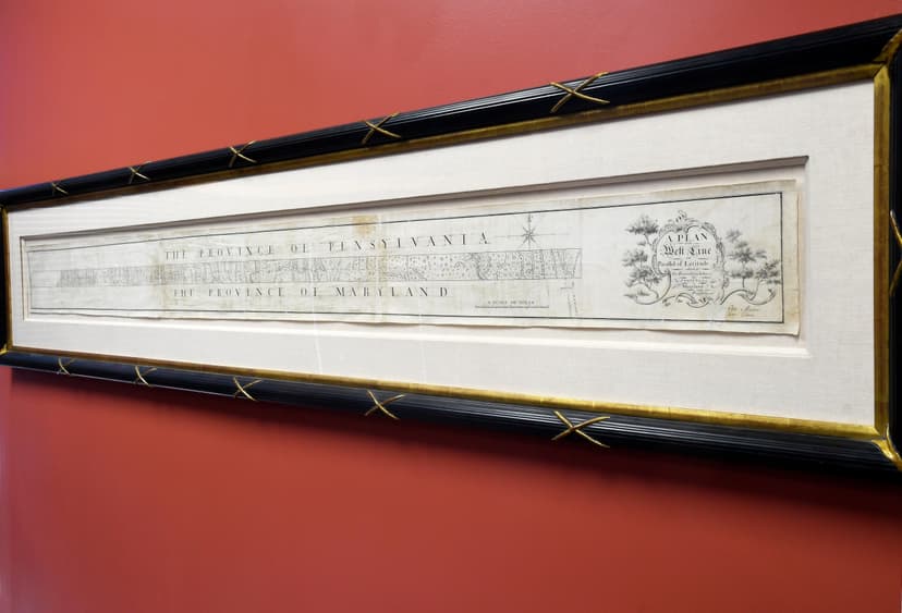
The first map depicting the Mason-Dixon Line, which historically delineated Northern free states from Southern slave states, is now up for auction. This consequential hand-drawn chart, created between 1767 and 1768 by Charles Mason and Jeremiah Dixon, was initially intended to resolve a border dispute between Maryland and Pennsylvania. Its significance grew when it was later used in the 1820 Missouri Compromise to define boundaries for slavery in the young United States.
The map, measuring 76 inches long and 6.5 inches tall, remained with the family of attorney Benjamin Chew for generations. In 1982, publisher Malcolm S. Forbes acquired it for $360,000, a record price for an American map at the time. It was sold again in 2002, with a section depicting the Delaware-Maryland border now housed at Princeton University. The auction is anticipated to bring between $800,000 and $1.2 million for the anonymous seller.


