Home / Weather / Yakima River Flooding: Worst in 30 Years Looms
Yakima River Flooding: Worst in 30 Years Looms
11 Dec, 2025
Summary
- Yakima River flood warning issued for communities up to the Columbia River.
- Expected crest of 15.8 feet on Friday is highest since 1996.
- Extensive flooding anticipated at RV parks, agricultural areas, and roads.
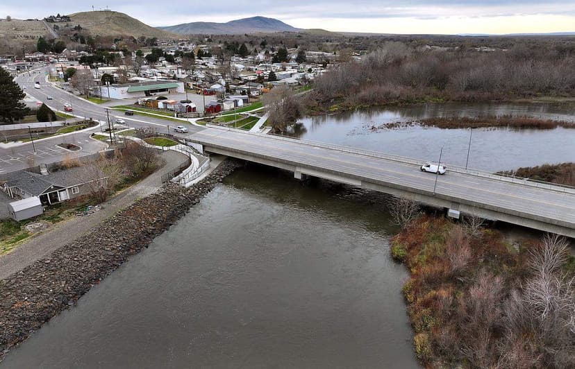
Communities along the Lower Yakima River, including West Richland, are anticipating the most significant flooding in almost three decades. A flood warning has been issued by the National Weather Service due to heavy rainfall in the Cascade Mountains from an atmospheric river. The river is expected to crest at 15.8 feet by late Friday, a level not seen since 1996.
This anticipated rise in water levels is projected to cause extensive flooding in low-lying agricultural areas, residential properties, and recreational spots like the West Richland Golf Course. Several roads are also at risk of inundation, leading officials to strongly advise drivers against attempting to cross flooded roadways. A section of the Yakima River Gateway trail has already been closed as a precautionary measure.
Residents are encouraged to sign up for emergency alerts and stay informed through local emergency management resources. The weather service has ranked the flood risk on the Yakima and Naches rivers as high, with evacuation orders already in place for areas along the Naches River. The situation remains critical as water levels are expected to recede by Monday.