Home / Weather / UK Braces for Snow: Cold Snap to Hit Early February
UK Braces for Snow: Cold Snap to Hit Early February
22 Jan
Summary
- Persistent heavy rain expected, with potential for flooding.
- Cold air from Scandinavia may bring snow to most areas.
- Snowfall most likely on Thursday, potentially reaching the Midlands.

A period of heavy and persistent rain is expected across the UK, primarily affecting southern and western areas, with drier interludes anticipated in the far north and northeast. While mild conditions may briefly encroach on the south and southwest, a significant temperature drop is forecast. This colder air, potentially originating from Scandinavia via the North Sea, could bring snow to many parts of the country.
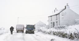
Early February could see this snow risk materialize, especially across hills in Scotland and northern England, with potential for extension to other regions. Thursday is highlighted as the most likely day for widespread snow, with flurries possibly reaching the Midlands. These conditions carry a high risk of flooding, with potential damage to homes and businesses, and deep or fast-flowing water posing a danger to life.
Forecasters also anticipate delays and cancellations to public transport services, including trains and buses. Other areas such as Cumbria, North Yorkshire, and West Yorkshire will also experience wet weather, and thundery conditions are possible in North Wales.


