Home / Weather / Tropical Disturbance Approaches Gulf Coast, Potential Impacts for Houston
Tropical Disturbance Approaches Gulf Coast, Potential Impacts for Houston
4 Oct, 2025
Summary
- Emerging disturbance in eastern Atlantic and near Florida could affect Houston
- Potential for increased showers and storms in Houston area next Monday and Tuesday
- Modest rainfall expected, with most areas seeing less than half an inch
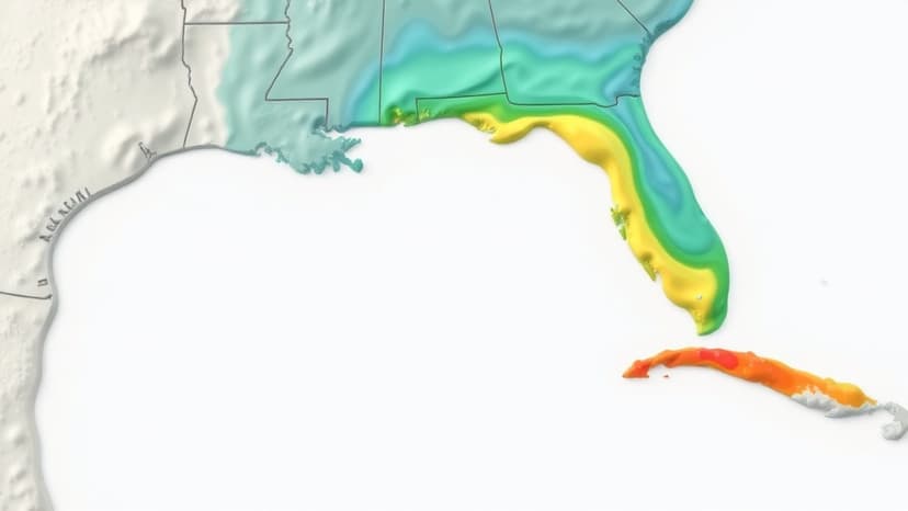
As of October 4th, 2025, a tropical disturbance is on the radar for the Gulf Coast region. According to the latest reports, one system over Africa is expected to emerge in the far eastern Atlantic by this Saturday, while another emerging disturbance would stretch from Florida's Atlantic coast, across the Florida Peninsula, and into the northeastern Gulf of Mexico.
This latter system, a remnant frontal boundary near Florida, could spin up an area of low pressure late this week or into the weekend. While the odds of significant development remain fairly low, with just a 10% chance over the next seven days, the system is still expected to send a surge of tropical moisture toward the Gulf Coast.
For the Houston area, this means an increased chance of showers and storms next Monday and Tuesday. The heaviest rainfall is currently forecast to fall near and south of New Orleans, but the Houston region is likely to experience some of the effects as well. However, rainfall totals in the Houston area are expected to be modest, with most spots seeing less than half an inch from the scattered downpours.
Despite the limited drought relief, the approaching system is still worth keeping an eye on, as it could influence the weather patterns in the Houston and Gulf Coast region in the coming days.