Home / Weather / Texas Braces for Major Flooding: Watch Issued!
Texas Braces for Major Flooding: Watch Issued!
20 Nov
Summary
- Flood watch issued for South and Central Texas from midnight tonight to Friday morning.
- 1-7 inches of rain possible, with highest totals expected in western areas.
- Strong low-pressure system approaching from the west brings potential for heavy rainfall.
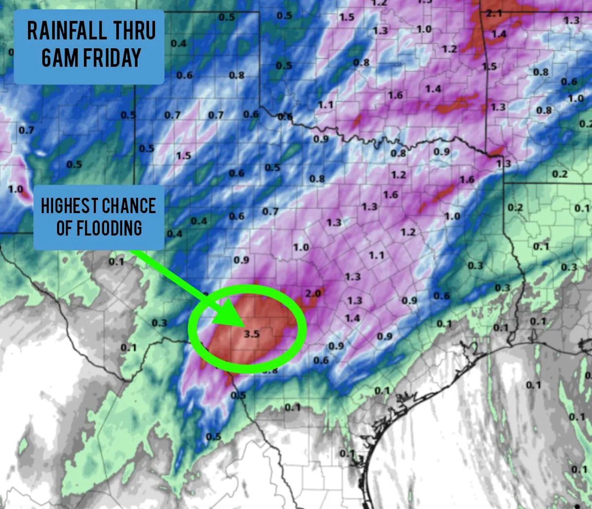
A significant flood watch has been declared for a substantial portion of South and Central Texas, commencing at midnight tonight and extending through 6 a.m. Friday. The alert signifies favorable conditions for potential flooding across numerous counties.
Forecasters anticipate rainfall totals ranging from 1 to 7 inches, with the highest amounts predicted for the western parts of the watch area, including cities like Del Rio and Rocksprings. Other areas may see between 1-3 inches, with isolated instances of urban flooding possible even in lighter rainfall zones.
The National Weather Service advises caution as excessive runoff could lead to flooding in rivers, creeks, and low-lying areas. The rainfall is expected in two rounds, with the first arriving overnight and a second expected Thursday afternoon into the evening.