Home / Weather / Calm After Storm: SA Weather Forecast
Calm After Storm: SA Weather Forecast
23 Sep
Summary
- Mixed weather expected with foggy mornings and afternoon thunderstorms.
- Warmer temperatures predicted for coastal regions.
- No severe weather warnings issued by SAWS for the day.
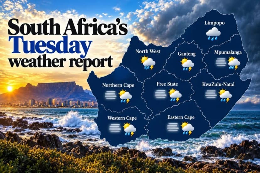
Tuesday, September 22nd, brings a varied weather outlook for South Africa, featuring foggy starts and afternoon thunderstorms. Gauteng and the North West will experience partly cloudy conditions with isolated showers and thundershowers developing in the afternoon.
The Free State can expect morning fog, particularly in the east and near the Lesotho border, before becoming partly cloudy and cool to warm with isolated afternoon showers.
Mpumalanga anticipates morning cloud and fog over the Highveld, becoming partly cloudy and cool, while the Lowveld remains warmer. Limpopo may see morning cloud, drizzle, and fog along the escarpment, with showers and thunderstorms expected later in the central and south-eastern parts.
The Northern Cape will experience morning fog in the south, followed by partly cloudy, cool to warm conditions and isolated afternoon showers. The Western Cape forecasts morning fog along the south coast, leading to partly cloudy, warm to hot weather, with Cape Town potentially reaching 28°C. Isolated showers are expected in parts of the province.
Eastern Cape residents can look forward to afternoon showers and thunderstorms, especially in the western half where scattered thunderstorms are predicted. KwaZulu-Natal will start with morning fog inland, becoming partly cloudy and cool to warm, with isolated afternoon showers and thunderstorms as coastal winds shift.
This forecast indicates a welcome reprieve from the severe weather warnings issued throughout the previous week, with SAWS issuing no advisories for Tuesday. However, given the widespread isolated showers, an umbrella is recommended.


