Home / Weather / Forecasters Warn of Potential Early-Season Snow Showers in NJ
Forecasters Warn of Potential Early-Season Snow Showers in NJ
8 Nov, 2025
Summary
- Chance of first snowflakes in New Jersey next week
- Cold front to bring rain showers this weekend
- Warm air mass expected to push temperatures into mid-60s on Saturday

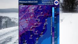
According to the latest weather forecasts, parts of New Jersey may see the first snowflakes of the season early next week. Meteorologists from AccuWeather and the National Weather Service say an upper-level disturbance could bring spotty snow showers to the state's northwestern region late Monday night into early Tuesday morning.
However, the weather service's Mount Holly forecast office notes that significant precipitation is not expected during this time. AccuWeather is also predicting some snow showers in the northwest corner of New Jersey, but no accumulations are anticipated.
Prior to the potential snowfall, a cold front will be moving across the state on Friday evening, bringing isolated to scattered rain showers to most of New Jersey Friday night into Saturday morning. Rainfall totals are expected to be minimal closer to the coast, with up to a quarter of an inch possible west of the I-95 corridor.
On Saturday, the clouds will give way to partly sunny skies as a warm air mass arrives, pushing afternoon temperatures into the mid-60s. More widespread rain is then expected to arrive in the Garden State on Sunday and could linger into Sunday night or early Monday, depending on the track of the storm system.