Home / Weather / Ontario Weather Alert: Snow, Ice, Rain & Thunderstorms Converge
Ontario Weather Alert: Snow, Ice, Rain & Thunderstorms Converge
31 Mar
Summary
- Southern Ontario faces thunderstorms with heavy rain and hail.
- Northern Ontario anticipates snow and freezing rain through Tuesday.
- Multiple storm systems to bring mixed precipitation later this week.
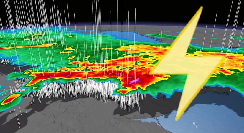
Ontario is currently experiencing a dramatic clash of weather patterns, with summer-like warmth in the south and lingering winter cold in the north. Southern Ontario, including the Greater Toronto and Hamilton Area, faced early morning thunderstorms with reports of hail and pooling water. A second wave of strong thunderstorms is anticipated later on Tuesday, bringing locally heavy rainfall of 20-40 mm, potential flooding, strong wind gusts, and small hail.
Meanwhile, northern Ontario is under a band of snow and freezing rain. Regions north and east of Lake Superior can expect snowfall accumulations of 5-15 cm, with heavier snow possible along Lake Superior's shores. Communities northeast of Georgian Bay may encounter periods of freezing rain and ice pellets, with potential for some ice buildup.
Looking ahead, Ontario is forecast to encounter two more rounds of stormy weather late in the week. A system arriving Thursday will bring snow and ice to the north and rain to the south. Another system on Saturday is expected to follow a similar path, delivering another mix of precipitation types as temperatures continue to fluctuate throughout April.