Home / Weather / NJ Under Storm Siege: Severe Thunderstorms & Flooding Warnings Issued
NJ Under Storm Siege: Severe Thunderstorms & Flooding Warnings Issued
20 Dec
Summary
- Severe thunderstorm warnings cover 15 New Jersey counties.
- A flood warning remains active for Hunterdon County due to rain and snowmelt.
- Wind advisories are in effect for all 21 New Jersey counties.
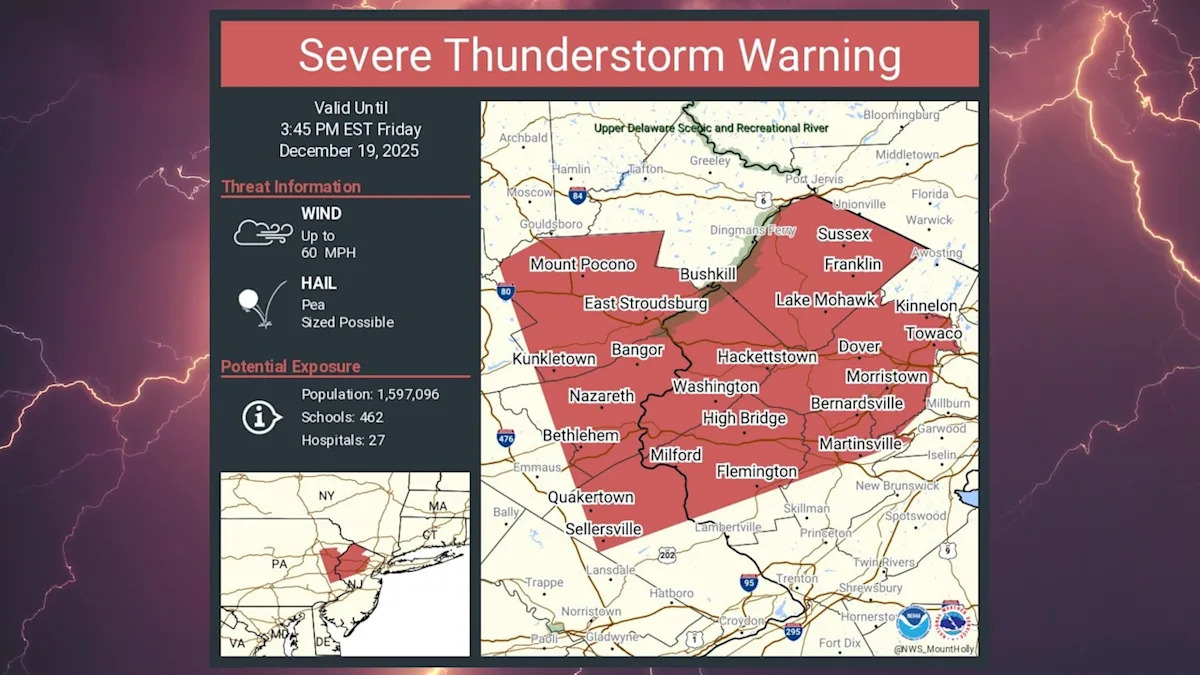
New Jersey is currently experiencing widespread severe weather, with the National Weather Service issuing multiple alerts. Severe thunderstorm warnings have been activated for fifteen counties, including Atlantic, Burlington, and Camden, with these alerts effective until late Friday afternoon. These storms are anticipated to bring strong, gusty winds capable of causing damage to roofs, siding, trees, and power lines.
In addition to the thunderstorms, a flood warning remains in effect for Hunterdon County until Friday afternoon. Excessive rainfall combined with snowmelt has led to rising river and stream levels, with the Neshanic River exceeding its flood stage. Roads near the river are subject to closure, and low-lying areas are already experiencing or are imminent for flooding.
Complementing the storm threats, wind advisories are active across all 21 counties in New Jersey, extending until early Saturday morning. Residents can expect west winds of 20 to 30 mph with gusts up to 50 mph. These strong winds pose a risk of toppling trees and power lines, adding to the list of weather concerns for the state.