Home / Weather / Newfoundland Faces Powerful November Storm Fueled by Bombogenesis
Newfoundland Faces Powerful November Storm Fueled by Bombogenesis
3 Nov
Summary
- Rapidly intensifying weather system approaching Newfoundland
- Potential for intense wind gusts, heavy rainfall, and snow
- Storm expected to undergo bombogenesis, a rapid deepening process
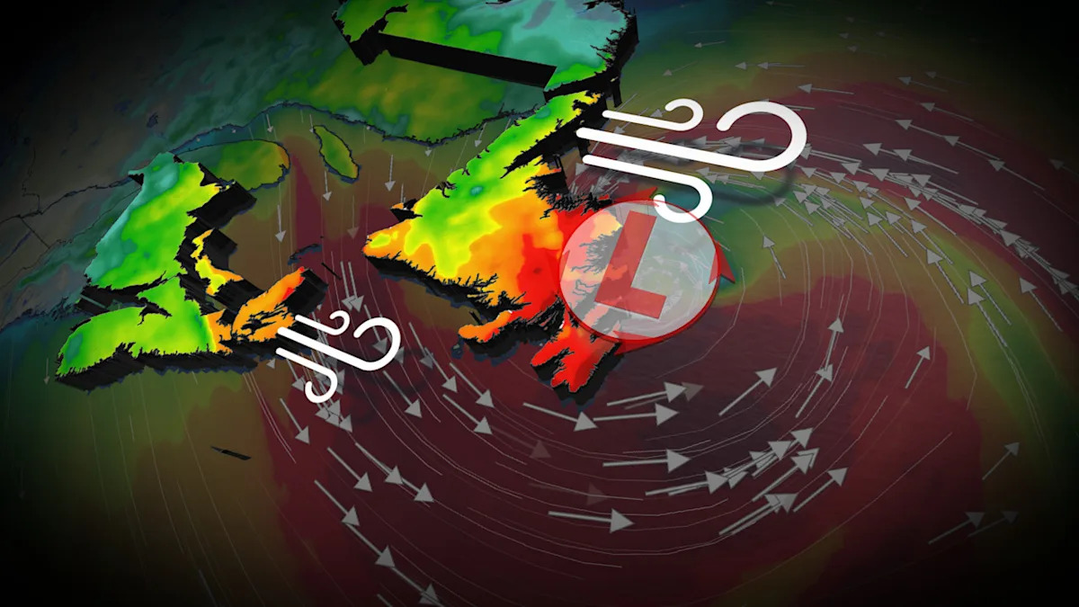
On November 3rd, 2025, a significant storm is developing and showing signs of rapid intensification. By Monday afternoon, a deep, cut-off trough is expected to interact with the warm waters of the Gulf Stream, generating a sharp temperature contrast between the ocean and the air.
Within 24 hours, a powerful low-pressure system is anticipated to approach Newfoundland. The storm will likely undergo bombogenesis, a rapid deepening process that turns the storm into a formidable low as it approaches Newfoundland on Tuesday.
Residents of Newfoundland and the surrounding region are bracing for the potential impacts of this powerful storm. Intense wind gusts of 90-100+ km/h are expected, with gusts exceeding 110 km/h possible, especially around Sable Island and southeastern coastal Newfoundland, including St. John's and the Avalon Peninsula. Heavy rainfall accumulations of 50-75 mm are expected in Cape Breton and along the Burgeo coast, with widespread amounts of 30-50 mm across the Avalon Peninsula. Wet snow may also develop in higher elevations in western Newfoundland and Labrador.