Home / Weather / Avoid I-70 Gridlock: New CDOT Webpage
Avoid I-70 Gridlock: New CDOT Webpage
24 Nov, 2025
Summary
- New webpage offers live cameras, road conditions, and weather alerts.
- The I-70 mountain corridor spans Golden to Glenwood Springs.
- CDOT aims to streamline mountain travel for residents and visitors.

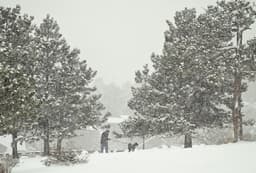
CDOT has launched a new webpage designed to alleviate traffic congestion and closure issues along Colorado's vital I-70 mountain corridor. This streamlined resource centralizes crucial information, including live camera feeds, current road conditions, weather forecasts, and traction law alerts, making mountain travel more predictable.
The I-70 mountain corridor, stretching from Golden to Glenwood Springs, is known for its steep elevation changes, sharp curves, and rapidly shifting weather. The new tool, featuring a "Mountain Road, Mountain Ready" tagline, empowers drivers to check plow status and travel forecasts before embarking on their journey.
This initiative is particularly beneficial for visitors unfamiliar with Colorado's high country conditions. CDOT plans to evaluate the webpage's success, potentially developing similar resources for other frequently impacted state highways, enhancing overall road safety and travel efficiency.