Home / Weather / Florida May See Snow Flurries After 16 Years
Florida May See Snow Flurries After 16 Years
29 Jan
Summary
- Tampa Bay has a 20% chance of snow flurries this weekend.
- The last snow flurries in Tampa were recorded on January 9, 2010.
- Extremely cold temperatures and wind chills are forecast for Florida.
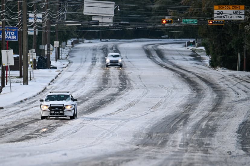
Winter Storms are expected to impact the U.S. Southeast this weekend, with a unique possibility of snow flurries reaching a Florida city not accustomed to such weather.
Tampa Bay faces a 10 to 20 percent chance of experiencing light snow flurries overnight Saturday into Sunday morning. This rare event would mark the first snowfall in the city since January 9, 2010. Meteorologists note that any flurries would likely be coastal, with "very breezy" conditions anticipated.
Beyond Tampa, other areas of Florida could also witness snow, with Jacksonville having the highest probability. The state is bracing for extremely cold temperatures, with wind chills potentially dropping into the single digits in Northern Florida. Areas as far south as Miami may experience temperatures near freezing, prompting cold weather advisvisories and potential extreme cold warnings.
Authorities are urging residents to take precautions, including wearing appropriate clothing, keeping pets indoors, and protecting sensitive plants from the frost and freezing conditions. Prolonged exposure to these temperatures can lead to hypothermia, and crops, vegetation, and outdoor plumbing are at risk.
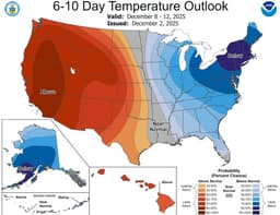
The cold snap is expected to persist, with forecasts indicating below-average temperatures across the eastern third of the U.S. through February 7, including Florida.