feedzop-word-mark-logo
searchLogin
Feedzop
homeFor YouIndiaIndia
You
bookmarksYour BookmarkshashtagYour Topics
Trending
Terms of UsePrivacy PolicyAboutJobsPartner With Us

© 2026 Advergame Technologies Pvt. Ltd. ("ATPL"). Gamezop ® & Quizzop ® are registered trademarks of ATPL.

Gamezop is a plug-and-play gaming platform that any app or website can integrate to bring casual gaming for its users. Gamezop also operates Quizzop, a quizzing platform, that digital products can add as a trivia section.

Over 5,000 products from more than 70 countries have integrated Gamezop and Quizzop. These include Amazon, Samsung Internet, Snap, Tata Play, AccuWeather, Paytm, Gulf News, and Branch.

Games and trivia increase user engagement significantly within all kinds of apps and websites, besides opening a new stream of advertising revenue. Gamezop and Quizzop take 30 minutes to integrate and can be used for free: both by the products integrating them and end users

Increase ad revenue and engagement on your app / website with games, quizzes, astrology, and cricket content. Visit: business.gamezop.com

Property Code: 5571

Home / Weather / Erie Buried: Lake-Effect Snow Dumps Inches

Erie Buried: Lake-Effect Snow Dumps Inches

16 Jan

•

Summary

  • Lake-effect snow warnings were in effect until early Friday.
  • Wesleyville and West Colt Station reported 7.5 inches of snow.
  • Additional accumulations of 4 to 10 inches were expected.
Erie Buried: Lake-Effect Snow Dumps Inches

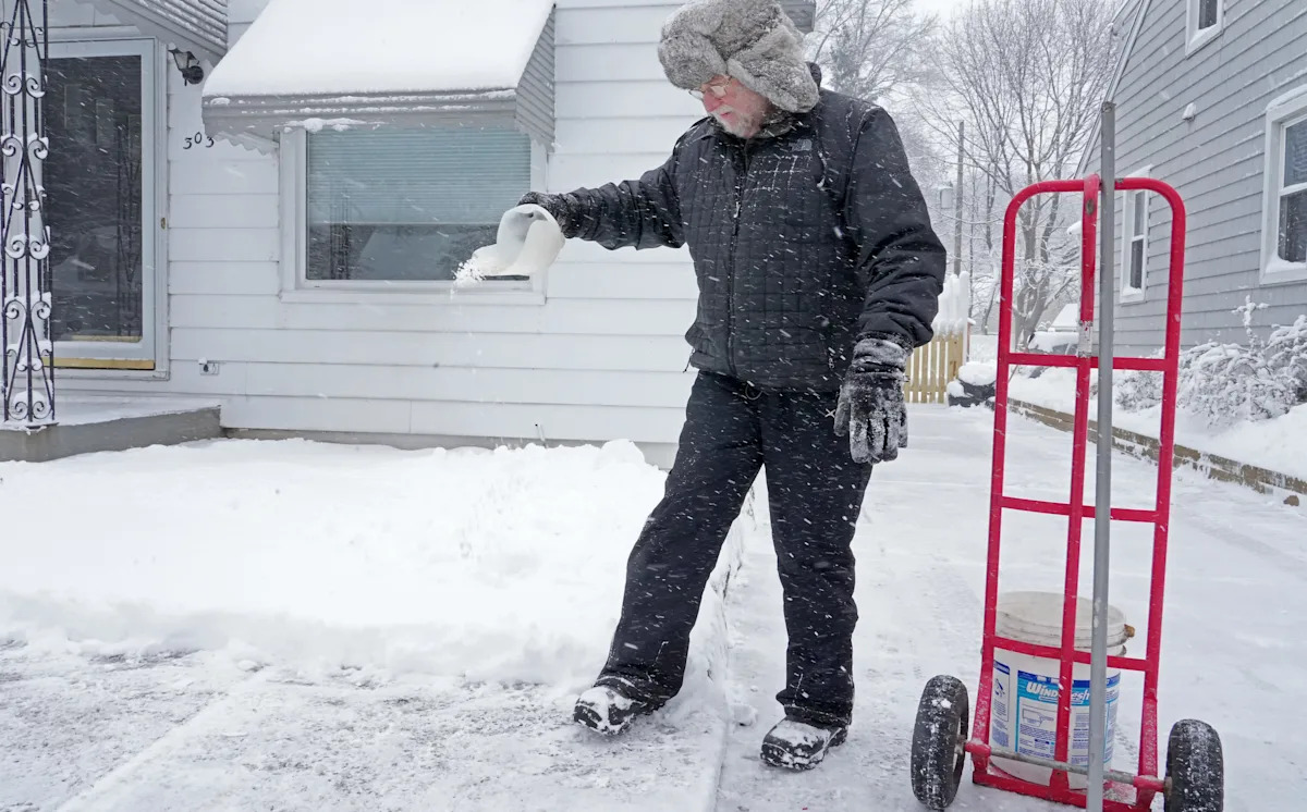
Lake-effect snow began blanketing Erie and Crawford counties on the night of Wednesday, January 14th, extending into Thursday, January 15th. The National Weather Service issued snow warnings that were set to expire early on Friday, January 16th. Trained weather spotters reported that Wesleyville and West Colt Station received the most snowfall, with 7.5 inches recorded in each location.

Additional accumulations of 4 to 10 inches were predicted for Thursday, January 15th, with the heaviest snowfall expected in the higher elevations of both Erie and Crawford counties. The forecast for Erie on January 15th included snow and patchy blowing snow, with potential for 3 to 7 inches of accumulation. Temperatures were expected to be around 22 degrees with wind chills as low as zero.

As of Friday, January 16th, the chance of snow diminished. Light snow was still possible, mainly after 1 p.m., with accumulations of less than an inch expected. The daytime high was forecast to be near 33 degrees. Overnight conditions on January 16th into the 17th could bring patchy blowing snow and less than half an inch of new accumulation with breezy conditions.

Disclaimer: This story has been auto-aggregated and auto-summarised by a computer program. This story has not been edited or created by the Feedzop team.
Wesleyville and West Colt Station reported 7.5 inches of snow, with additional accumulations of 4 to 10 inches expected.
Lake-effect snow warnings were in effect from Wednesday night, January 14th, into early Friday morning, January 16th.
After the main snow event, light snow and patchy blowing snow were possible on January 16th and 17th, with minimal accumulation.

Read more news on

Weatherside-arrow
trending

Rafale jets to be built in India

trending

Praveen Kumar heads BSF

trending

Galaxy S26 Ultra: Development begins

trending

Silver hits all-time high

trending

NFVCB targets film classification

trending

Apple Creator Studio Subscription

trending

CBI searches Kolkata locations

trending

Nithin Kamath questions market closure

trending

iPhone 15 Pro Max Review

You may also like

Sudden Snow Squall Threatens Tri-State Area Roads

1 Jan • 62 reads

article image

Coshocton Sees Below-Average Temps, Flurries Ahead

1 Jan • 81 reads

article image

Dangerous Winds of 75 MPH to Hit Northern CA

16 Dec, 2025 • 186 reads

article image

Cincinnati Braces for Snow Barrage: Advisory, Then Storm Watch

13 Dec, 2025 • 164 reads

article image

Lake Effect Snow Warning Issued for Wayne, Cayuga Counties

10 Dec, 2025 • 198 reads

article image