Home / Weather / DMV Braces for Storms: Severe Weather Threat Looms
DMV Braces for Storms: Severe Weather Threat Looms
12 Oct
Summary
- Strong storms with damaging winds are possible Sunday afternoon.
- A low-end chance exists for a quick spin-up tornado.
- Temperatures will remain warm through midweek, then cool significantly.
The DMV area is anticipating a continuation of rain this Sunday, with a First Warn issued for the potential of stronger storms from the afternoon through the evening. Steady rain is expected to taper off in the early afternoon, offering a dry interval before another round of weather activity arrives.
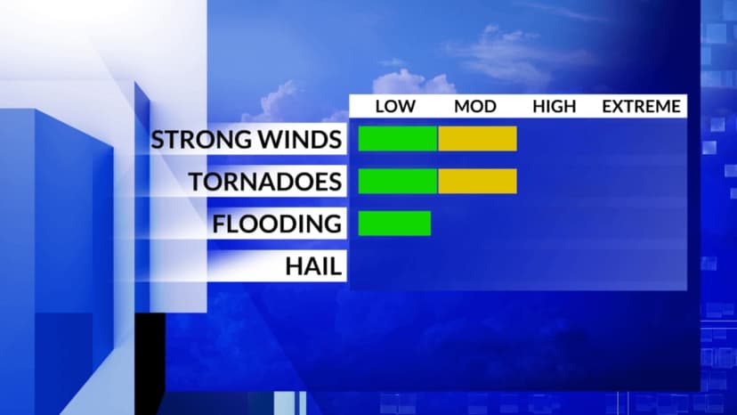
Most of the DMV is under a Level 1 threat for severe weather, with areas south of the Metro facing a Level 2 risk. Between 4 p.m. and 9 p.m., there is a low probability of storms producing damaging winds or a quick spin-up tornado, particularly if conditions become more humid with some sunshine. This threat is not widespread but warrants attention, with multiple alert methods recommended.
Any severe weather threat is predicted to diminish overnight, leaving only scattered showers into Monday morning. Rain will fully exit after the morning commute, leading to a breezy day with intermittent sunshine. Temperatures are expected to stay warm, in the 70s, through midweek with sunny conditions on Tuesday and Wednesday.
A cold front will move through the DMV mid-week, causing temperatures to drop into the 60s. Another cold front is projected for next weekend, potentially bringing a more substantial cool-down to the region.


