Home / Weather / Arctic Blast Grips D.C. Waters Freeze Over
Arctic Blast Grips D.C. Waters Freeze Over
27 Jan
Summary
- D.C. temperatures dropped below zero, with wind chills in the single digits.
- This cold spell may rank among the most severe since the late 1800s.
- Local waterways, including parts of the Potomac River, are beginning to freeze over.
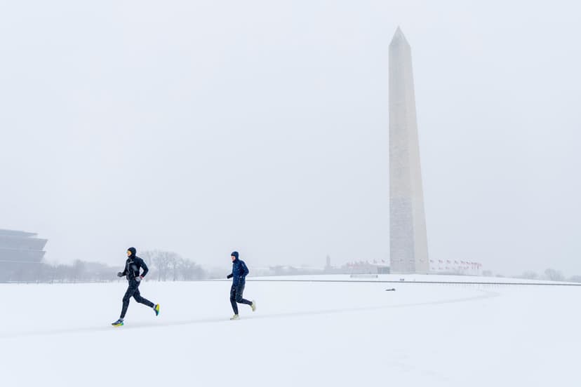
Washington D.C. is currently enduring a severe cold snap, with Tuesday morning temperatures dropping to 13 degrees and many regional areas falling into the single digits or below zero. Wind chills have dipped below zero, prompting multiple cold weather advisories from the National Weather Service. This frigid spell, which began ramping up on Saturday, could be among the most severe since the late 1800s.
The deep freeze has begun to impact local waterways, with portions of the Potomac River already icing over. The persistence of these frigid temperatures ensures that the snow and ice from Sunday's storm will linger for at least another 7 to 10 days. Computer models suggest that highs will remain in the 20s or lower for at least six more consecutive days.
This cold pattern is attributed to a deep dip in the jet stream across eastern North America, funneling Arctic air southward. While this cold snap is significant, it does not alter the long-term global warming trend, as 2025 was the planet's third hottest year on record. The current extreme cold is a rare weather event caused by a specific configuration of atmospheric pressure systems.