Home / Weather / Cyclone Arnab Weakens, New System Brews
Cyclone Arnab Weakens, New System Brews
30 Oct
Summary
- Cyclone Arnab weakened from a severe storm to a low-pressure area.
- Remnants of Arnab are causing rainfall across eastern and central India.
- A new low-pressure system is developing over the Andaman Sea.
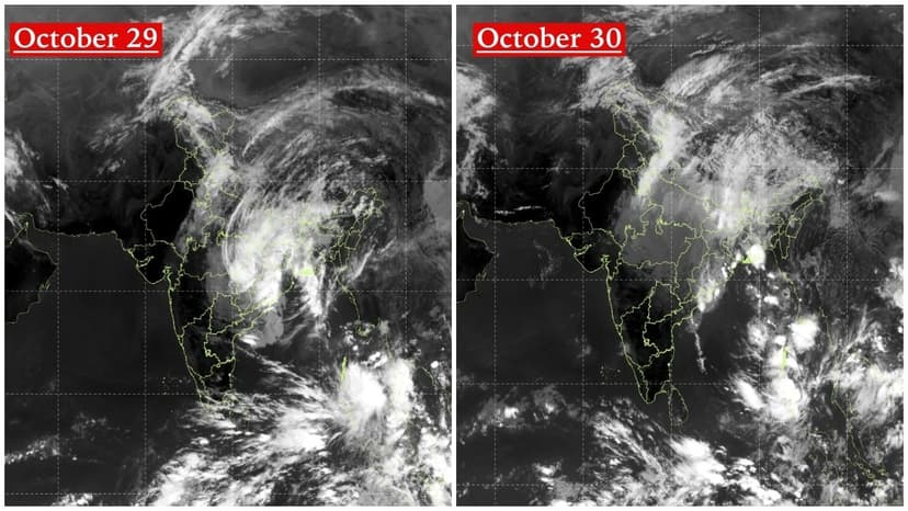
INSAT-3DS satellite images from October 29 and 30 show Cyclone Arnab moving northwards and weakening over land. Initially a very severe cyclonic storm over the Bay of Bengal, Arnab's remnants transformed into a well-marked low-pressure area over central Chhattisgarh and adjoining Odisha by October 29. The system was expected to move north-northeast and weaken further.
Despite its weakening, Arnab's circulation and moisture are still expected to trigger rainfall and thunderstorms across parts of eastern and central India. Concurrently, a new area of intense cloud activity has been detected over the South Andaman Sea. This developing low-pressure area, designated system A, is now also a focus for meteorologists.
These two satellite images effectively illustrate the contrasting weather developments. While Cyclone Arnab completes its lifecycle over land, a fresh weather disturbance is forming over the Andaman Sea. The primary focus for meteorologists has shifted from Arnab's intensity to its rainfall impact and the potential evolution of the new Andaman Sea system.


