Home / Technology / Ships Lost at Sea: GPS Failures Plague Middle East
Ships Lost at Sea: GPS Failures Plague Middle East
8 Mar
Summary
- Around 1,000 ships in the Gulf struggle with outdated GPS, half of the area's vessels.
- Vessels rely on early 1990s GPS signals, unable to use newer satellite systems.
- Signal jamming and spoofing create dangerous navigation hazards, impacting ship systems.
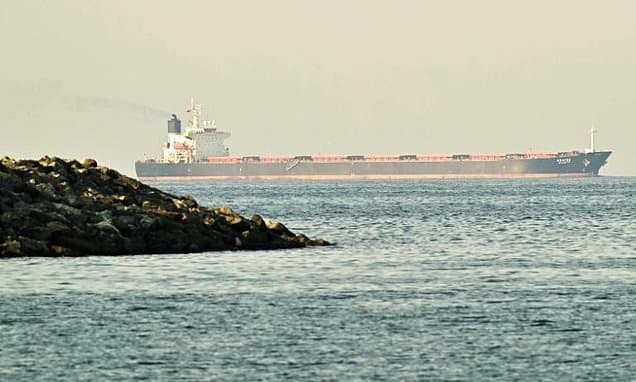
An estimated 1,000 cargo ships and oil tankers in the Middle East are experiencing significant navigation difficulties due to their outdated GPS capabilities, impacting roughly half of the vessels in the affected region, primarily off the United Arab Emirates and Oman. These ships predominantly utilize the L1 C/A signal, the original civilian GPS signal from the early 1990s. This makes them unable to access or rely on more modern satellite navigation systems such as Europe's Galileo or China's BeiDou.
Signal jamming, a relatively simple process involving a louder radio transmitter, creates navigational chaos. More sophisticated spoofing can manipulate a vessel's Automatic Identification System (AIS), causing it to broadcast a false or nonsensical location. This is particularly concerning as GPS signals are crucial not only for location but also for powering onboard clocks, radar systems, and speed logs. Even if protected from direct threats, navigating without reliable GPS becomes a perilous task.
Several Gulf states, as well as Israel and Iran, have employed GPS jamming, often defensively to counter drone threats. This strategy, though deemed acceptable by these nations, disrupts their own air and maritime traffic, and potentially other services like dating apps. While alternative navigation technologies are in development, ships currently face the challenge of navigating without the crucial assistance of modern GPS systems.