feedzop-word-mark-logo
searchLogin
Feedzop
homeFor YouIndiaIndia
You
bookmarksYour BookmarkshashtagYour Topics
Trending
trending

Navi Mumbai Airport opens today

trending

New airlines launch in India

trending

Akshaye Khanna exits Drishyam 3

trending

Libyan officials die in Turkey

trending

Nigeria open banking potential

trending

Hawaii Bowl live stream options

trending

Gemini AI Android multitasking boost

trending

Cameroon vs Gabon AFCON

trending

Bumrah skips Vijay Hazare Trophy

Terms of UsePrivacy PolicyAboutJobsPartner With Us

© 2025 Advergame Technologies Pvt. Ltd. ("ATPL"). Gamezop ® & Quizzop ® are registered trademarks of ATPL.

Gamezop is a plug-and-play gaming platform that any app or website can integrate to bring casual gaming for its users. Gamezop also operates Quizzop, a quizzing platform, that digital products can add as a trivia section.

Over 5,000 products from more than 70 countries have integrated Gamezop and Quizzop. These include Amazon, Samsung Internet, Snap, Tata Play, AccuWeather, Paytm, Gulf News, and Branch.

Games and trivia increase user engagement significantly within all kinds of apps and websites, besides opening a new stream of advertising revenue. Gamezop and Quizzop take 30 minutes to integrate and can be used for free: both by the products integrating them and end users

Increase ad revenue and engagement on your app / website with games, quizzes, astrology, and cricket content. Visit: business.gamezop.com

Property Code: 5571

Home / Technology / See Every Building on Earth in 3D

See Every Building on Earth in 3D

3 Dec

•

Summary

  • A 3D map of 2.75 billion buildings worldwide was created.
  • The map offers 30 times finer resolution than previous datasets.
  • It aids in studying urbanization, poverty, and climate change impacts.
See Every Building on Earth in 3D

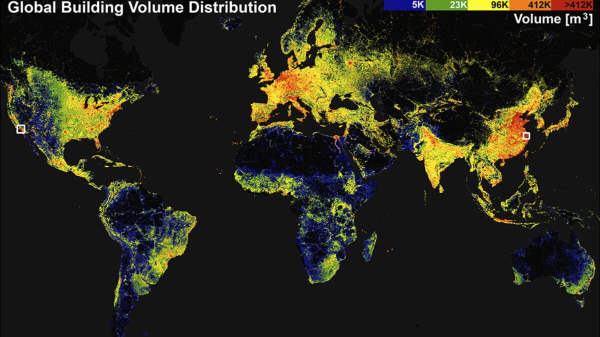
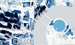
Researchers at the Technical University of Munich have unveiled the GlobalBuildingAtlas, a high-resolution 3D map detailing all buildings across the globe. This expansive dataset comprises 2.75 billion building models, significantly surpassing previous global datasets in both quantity and detail.

The GlobalBuildingAtlas is designed to address critical socioeconomic and environmental issues. It provides insights into urbanization patterns, poverty distribution, and potential impacts of climate change by mapping building volume relative to population.

The map's detailed information is invaluable for urban planning and policy-making, particularly in resource-limited areas. Agencies are already exploring its use for evaluating disaster risks, highlighting its potential for global development and safety.

Disclaimer: This story has been auto-aggregated and auto-summarised by a computer program. This story has not been edited or created by the Feedzop team.
The GlobalBuildingAtlas is a high-resolution 3D map created by researchers at the Technical University of Munich, detailing 2.75 billion buildings worldwide.
The map offers 30 times finer resolution than comparable databases and includes data filtering for varied satellite image quality.
It serves socioeconomic and environmental purposes, aiding studies on urbanization, poverty, climate change, and disaster risk evaluation.

Read more news on

Technologyside-arrow

You may also like

Global IMC Exits Adtalem Stake

21 Dec • 19 reads

article image

3D Map Reveals Earth's 2.75 Billion Buildings

16 Dec • 45 reads

article image

Student Finds Freedom and Affordability in German Med School

8 Dec • 73 reads

article image

Switzerland's Yodel Song Aims for UN Heritage Status

5 Dec • 69 reads

article image

Polio Virus Detected in Hamburg Sewage, Raising Alarm

13 Nov • 175 reads

article image