Home / Technology / 3D Map Reveals Earth's 2.75 Billion Buildings
3D Map Reveals Earth's 2.75 Billion Buildings
16 Dec
Summary
- A new 3D map charts 2.75 billion buildings globally.
- AI and satellite data created the detailed GlobalBuildingAtlas.
- Building volume per capita is a new development indicator.
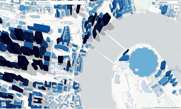
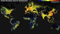
Researchers from the Technical University of Munich have unveiled the GlobalBuildingAtlas, an unprecedented 3D map charting the location and size of 2.75 billion buildings across the globe. Leveraging nearly 800,000 satellite images from 2019 and an AI algorithm, the map provides a detailed representation of urbanization, offering insights into living conditions that traditional 2D maps cannot match. The resolution in urban areas is exceptionally high, approximately 30 times finer than existing databases.
The creation of such a detailed global building map was historically challenging due to the need for specialized laser-scanning satellites. The German team's innovative approach combined existing laser-scan data with AI to predict and map buildings where data was sparse. This has resulted in a powerful tool for studying development, planning urban growth, and preparing for disasters. The map covers diverse locations, from historic structures to dense cityscapes and remote settlements.