Home / Science / Antarctica's Hidden World Revealed by New Ice Map
Antarctica's Hidden World Revealed by New Ice Map
17 Jan
Summary
- A new map details Antarctica's hidden landscape beneath its ice sheet.
- Scientists used satellite data and glacier movement to create the map.
- The map reveals thousands of unknown hills and clearer mountain ranges.
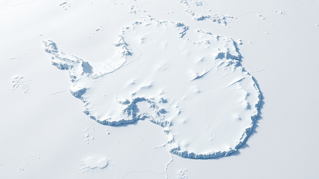
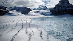
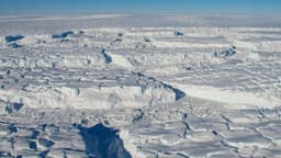
A new map offers an unprecedented, detailed view of Antarctica's hidden terrain lying beneath its thick ice sheet. This significant advancement is helping scientists better comprehend the frozen continent and anticipate its future behavior.
The creation of this map involved sophisticated analysis of satellite data combined with observations of glacier movements. This process illuminated thousands of previously unmapped hills and undulations, while also clarifying the features of several mountain ranges that were previously obscured. Researchers acknowledge that while the map is not perfectly accurate, it represents a major step forward in understanding subglacial topography.
This enhanced understanding is vital for predicting Antarctica's response to climate change and its potential effects on global sea levels. Previous methods, like radar surveys, were limited by narrow flight paths, leaving vast data gaps. The new comprehensive map provides a clearer picture, likened to transitioning from a blurry image to a sharp digital photograph, offering crucial insights into a landscape previously largely hidden from view.