Home / Environment / UK Braces for Snow: Wintry Showers on the Horizon
UK Braces for Snow: Wintry Showers on the Horizon
18 Nov
Summary
- Snowfall is expected across 34 UK counties by Sunday, November 29.
- Temperatures could plunge to -4C in rural Scotland, with snow possible.
- Yellow warning for snow was issued earlier this week for parts of England and Scotland.
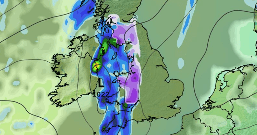
The United Kingdom is preparing for more wintry conditions as weather forecasting models indicate the possibility of further snow showers in the coming days. Earlier this week, the Met Office issued a yellow warning for snow, affecting areas in central and northern England, as well as Scotland. Data from the GFS weather model suggests that temperatures could fall below freezing across the last weekend of November.
Minimum temperatures predicted for midday on Saturday, November 28, show highs around 2C in London, 1C in the Midlands, and 0-1C near Glasgow and Edinburgh. Rural areas are expected to experience even colder conditions, with temperatures possibly reaching -2C in central Wales and -4C in northern Scotland. These low temperatures could lead to snow.
The GFS model maps indicate snow arriving in western and central Scotland around 3 am on Sunday, November 29. By 6 am, snow is expected in Wales, particularly over Snowdonia, and in parts of southern Scotland. By 9 am, the snow could impact northern England and areas near the England-Wales border. Snow depth data suggests accumulations of up to 6cm in rural Scotland, 3cm in Snowdonia, and 1cm in the Lake District and Pennines.
This period of cold weather could see precipitation falling as snow, especially on hills, with the potential for occasional strong winds. While some regions might experience milder, wetter weather, northern areas are expected to be colder, allowing for snow, mainly over higher ground. An increasing chance of high pressure influencing the weather later in November could bring more settled conditions.


