Home / Environment / UK Faces Arctic Blast: Snowfall Expected This Week!
UK Faces Arctic Blast: Snowfall Expected This Week!
12 Nov
Summary
- Wintry showers including snow are possible over high ground in Scotland.
- Temperatures have dropped below freezing, with lows of -8C in rural areas.
- Snow flurries may reach England and Wales next week, affecting 26 counties.
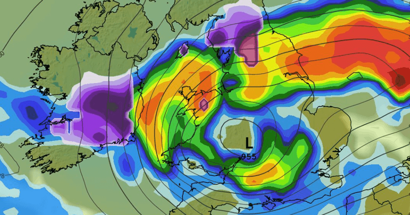
Wintry showers, including snow, are forecast for higher elevations in Scotland throughout this week. Temperatures across the UK have fallen below freezing, with rural areas potentially experiencing lows of -8C. Some models suggest that by next week, snow flurries could reach parts of England and Wales.
The GFS weather model indicates snow might arrive in Ireland, North Wales, and northern England starting Tuesday afternoon. By Tuesday evening, light flurries are expected in eastern and northeastern England, with heavier snow continuing in Scotland. Significant snow accumulation is possible over high ground in Scotland and Snowdonia.
This cold spell is attributed to shifts in high pressure altering wind direction, drawing in Arctic air. Forecasters clarify that this event is not linked to sudden stratospheric warming or a weakening polar vortex, but rather developments in the troposphere. While the polar vortex is being monitored, current conditions are expected to be short-lived.


