Home / Environment / UK Faces 600-Mile Snow Wall
UK Faces 600-Mile Snow Wall
2 Feb
Summary
- A 600-mile snow wall is predicted to cover the UK.
- Freezing rain is expected in southern Wales.
- Snowfall will continue until at least February 15.
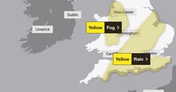
A substantial cold front is set to sweep across the UK, bringing a widespread snow event stretching approximately 600 miles. Weather maps indicate this Arctic system arriving before February 13, potentially dusting the entire country. While the majority of snowfall is expected to be minimal, a more significant threat of rare freezing rain is forecast for southern Wales, specifically north of Newport and Cardiff.
This freezing rain is anticipated to occur over a limited area, including locations like Carphilly, Cwmbran, and Pontypool, as temperatures plummet to -4C. The hazardous conditions are expected to be brief, concluding by 6 PM on February 13. Following this, snow is predicted to remain settled across the country until at least February 15, with a broader forecast of rain and colder air expected.
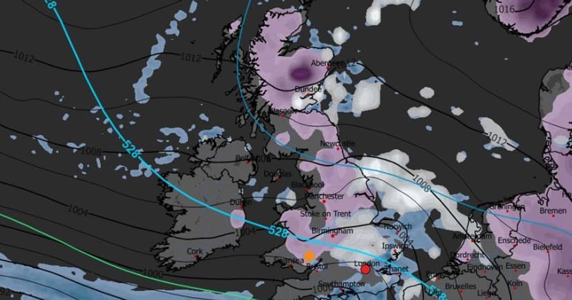
The Met Office's long-range forecast for February 6 to February 15 highlights the possibility of frontal systems encountering a blocking high-pressure area. This interaction could lead to further rain spells, particularly in flood-prone areas. As these rain bands move north, colder air may cause snow, especially over higher ground in northern England and Scotland. A subtle southward shift in low-pressure systems during the second week of February could increase the risk of wintry hazards across larger parts of the UK, including the south.