Home / Environment / Texas Braces for Severe Storms: Flash Flood Fears Rise
Texas Braces for Severe Storms: Flash Flood Fears Rise
13 Apr
Summary
- Severe thunderstorms forecast for Plains and central Texas.
- Large hail, damaging winds, tornadoes, and flash floods possible.
- Flash flooding history in Hill Country's Guadalupe River corridor.
The National Weather Service Weather Prediction Center has issued warnings for strong to severe thunderstorms expected across the Southern and Central Plains, with a heightened threat over central Texas persisting into Monday. Residents are advised of potential large hail, damaging winds, tornadoes, and flash flooding.
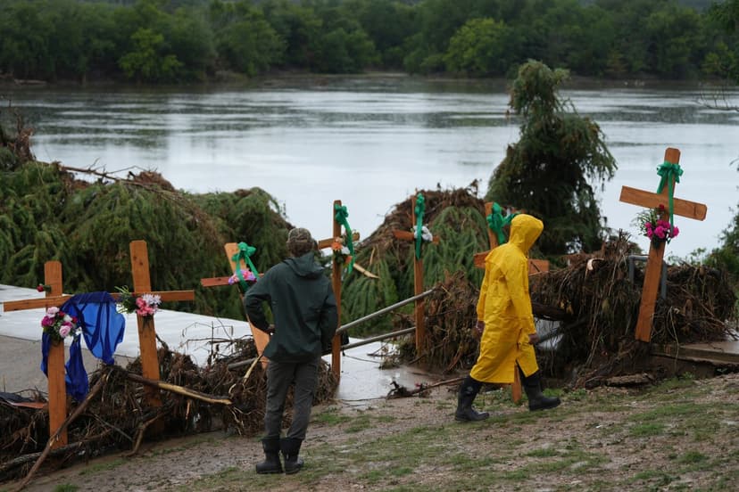
Central Texas's Hill Country has a documented vulnerability to flash flooding that can escalate rapidly, as tragically evidenced by the July 4, 2025, floods along the Guadalupe River. That event caused catastrophic damage and resulted in at least 129 deaths and 166 missing individuals.
The current forecast indicates severe thunderstorms and heavy downpours affecting the Plains Sunday night, with the severe weather threat continuing over central Texas Monday. Multiple counties have activated emergency management agencies in anticipation of potential flooding, urging residents to stay aware of their surroundings and avoid driving through flooded roads.
Officials in Kerr County, the site of last year's deadly floods, note a strong possibility of storms with rainfall rates exceeding 2 inches per hour. The NWS advisory highlights the potential for life-threatening flooding, with excessive runoff possibly overwhelming rivers, creeks, and low-lying areas.