Home / Environment / Half the Country Faces Severe Thunderstorm Risk
Half the Country Faces Severe Thunderstorm Risk
28 Feb
Summary
- Severe thunderstorms possible from Plains to Mississippi Valley.
- Warm air surge and strong winds set stage for storms.
- Preparation is urged for potential severe weather events.
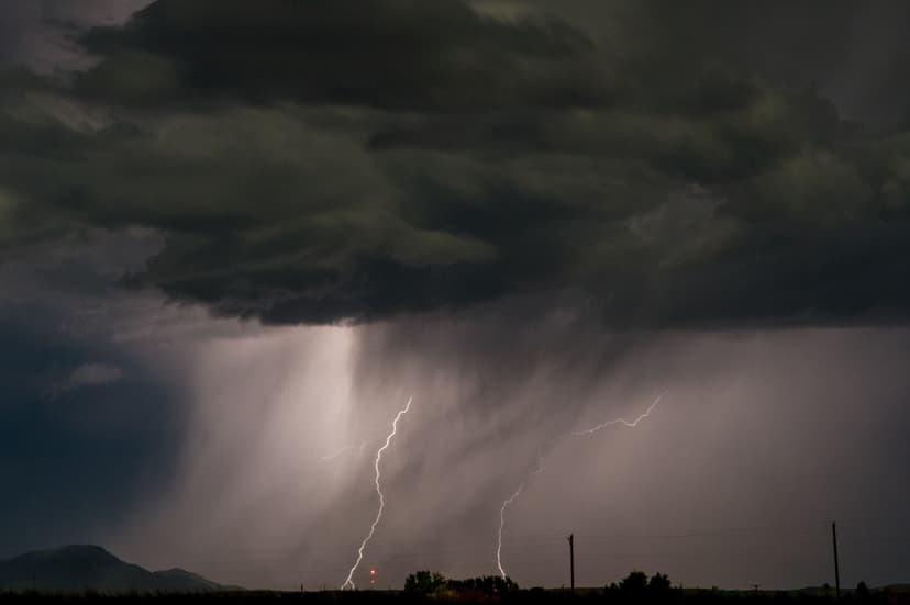
A substantial shift in the nation's weather pattern is poised to place nearly half the country at risk for severe thunderstorms. The National Weather Service's Storm Prediction Center has issued guidance indicating the atmosphere is primed for more active spring conditions. This change heralds the possibility of rain, thunderstorms, and severe weather developing from the Plains into the Mississippi and Ohio valleys as early March approaches.
The incoming severe weather marks an abrupt departure from the recent winter conditions experienced in the Midwest, Great Lakes, and Northeast. Warmer air is surging northward, and stronger upper-level winds are establishing the conditions necessary for widespread thunderstorm development. Meteorologists describe this impending shift as a "clash between winter and spring."
States facing the highest risk include Texas, Louisiana, Arkansas, Oklahoma, Missouri, Mississippi, Tennessee, Kentucky, Indiana, and Illinois. While no severe weather watches or warnings are currently in effect, emergency managers stress the importance of proactive preparation. This includes monitoring daily forecasts, ensuring multiple ways to receive warnings, and securing outdoor items. Families are also advised to review communication plans and prepare emergency kits for at least 24 to 48 hours.
AccuWeather meteorologists also warn of potential impacts in the Southeast, noting that following short-term rain, there may be limited opportunities for precipitation through much of the first half of March. This could lead to worsening drought conditions and an increased risk of wildfires in the region.