Home / Environment / Mapping Hidden Roads to Save Rainforests
Mapping Hidden Roads to Save Rainforests
23 Dec, 2025
Summary
- New research maps areas at high risk of deforestation.
- Illegal 'ghost' roads are up to seven times more common than official ones.
- One kilometer of new road can lead to 50 kilometers of secondary roads.

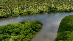
New research offers a critical tool to anticipate and prevent deforestation by predicting where new roads will be built in tropical forests. These "ghost" roads, often constructed illegally and undetectable on official maps, are precursors to significant forest destruction. A study analyzed existing road networks in tropical forests across Brazil, Congo, and Southeast Asia to identify features that promote new construction.
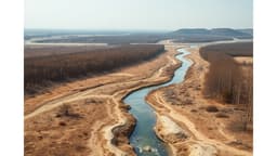
Understanding factors like soil type, proximity to rivers, topography, and population density allows researchers to pinpoint high-risk areas. These predictions are vital as unmapped roads can be up to seven times more common than official ones. The consequences are severe, as a single kilometer of new road can spur the construction of 50 additional kilometers of secondary roads, leading to vastly amplified deforestation.
While this predictive model is a significant step, it acknowledges limitations in accounting for political decisions. For example, the controversial plan to pave the BR-319 highway in the Brazilian Amazon, despite a low-risk assessment, highlights the influence of government projects on deforestation. Environmentalists caution that this highway could expose large areas of protected rainforest to logging, fires, and poaching, underscoring the complex interplay of research and policy in conservation efforts.