Home / Environment / Lake Powell Shrinks Dramatically: See the 9-Year Change
Lake Powell Shrinks Dramatically: See the 9-Year Change
19 Sep
Summary
- Satellite images show Lake Powell's drastic shrinkage over nine years.
- The reservoir reached record low levels in the Colorado River system.
- New projections suggest Lake Powell's levels could rise in coming years.
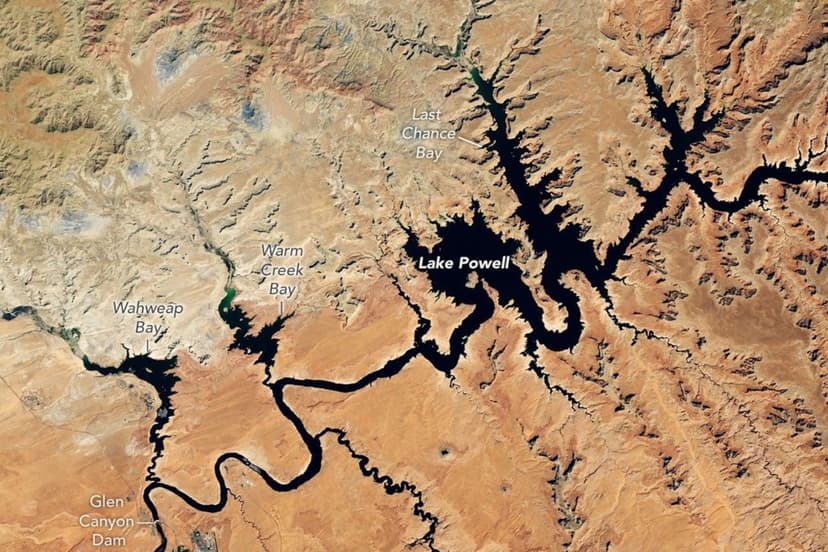
Satellite images released this week dramatically illustrate the nine-year retreat of Lake Powell, a crucial reservoir on the Colorado River. Comparing visuals from September 1, 2017, to September 10, 2026, reveals a substantial decrease in water levels. The 2026 image shows the reservoir at 3,517.24 feet, below its previous record low set in April 2023.
Lake Powell, the second-largest U.S. reservoir, is essential to the Colorado River system, supplying water to tens of millions across seven states and Mexico. The region has experienced prolonged drought, leading to record lows not only in Powell but also in Lake Mead, the nation's largest reservoir. Federal water managers have implemented interventions, including releases from upstream reservoirs, to mitigate further decline and protect hydropower production at Glen Canyon Dam.
Despite recent lows, new federal projections from the Bureau of Reclamation indicate a potential recovery for Lake Powell. These forecasts suggest the reservoir's water level could rise by approximately 40 feet by June 2028. However, these projections also anticipate a continued decline for Lake Mead during the same period.


